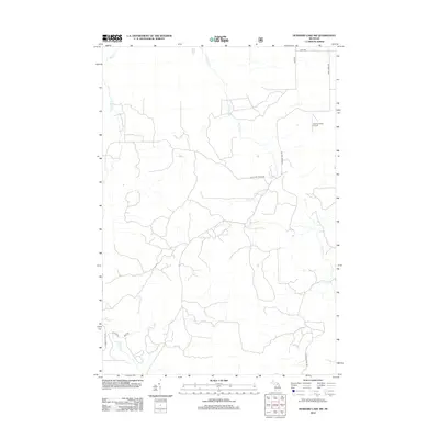
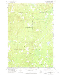
2012 Map of Hubbard Lake SW
USGS Topo · Published 2012About this map
The Vlachos Acres Airport sits on a high point in this northern Michigan landscape, where a dense network of tributaries feeds the regional watershed during the early twenty-first century. The terrain is defined by the winding paths of Wolf Cr and Little Wolf Cr in the northwest, while Widner Cr, Davis Cr, and Little N Cr drain the central and eastern sections. This geography is interlaced with a grid of rural roads and timber trails, including W Fruchey Ranch Rd and Hubbard Lake Trl. In the southern portion of the quadrangle, Wildcat Cr and Cabbage Cr navigate the lowlands, reflecting the intricate hydrography typical of the Alpena County interior. The presence of Consolidated Rd and several named ranch roads suggests a landscape shaped by both private landholding and recreational access.
Find a feature on this map
16 named features on this map. Tap any name to fly to it.
Don’t see what you’re looking for? This feature index may not catch every label — zoom into the map to look around manually.
Map Details
Editions of this 2012 Hubbard Lake SW Map
This is the sole edition of this map. No revisions or reprints were ever made.
Other maps of this area

1954 · Tawas City
USGS Topo · 1:250,000

1958 · Tawas City
USGS Topo · 1:250,000

1959 · Glennie
USGS Topo · 1:62,500

1972 · Hubbard Lake
USGS Topo · 1:24,000

1972 · Curran
USGS Topo · 1:24,000

1972 · Hubbard Lake SW
USGS Topo · 1:24,000
1972 · Big Ravine Creek
USGS Topo · 1:24,000
1972 · Beaver Lake
USGS Topo · 1:24,000
1972 · Evans Creek
USGS Topo · 1:24,000
1972 · McGinn Creek
USGS Topo · 1:24,000
Featured Places
- Ossineke Township, MI
- Mitchell Township, MI
- Caledonia Township, MI
- Hawes Township, MI
- Alcona Township, MI