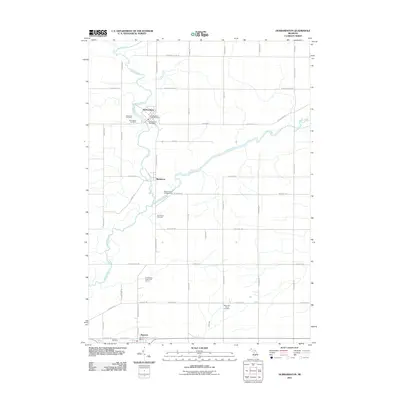
2011 Map of Hubbardston
USGS Topo · Published 2011About this map
Hubbardston sits at the northern edge of this landscape, its village streets clustered near the winding Fish Creek. This early 21st-century documentation reveals a rural community defined by its watercourses and a deep-rooted network of local burying grounds, including Saint Johns Cemetery, West Side Cemetery, and Hubbardston East Cemetery. The terrain is divided by the Maple River, which snakes across the center of the sheet past the settlement of Matherton and the Maple River Campground. To the south, the village of Pewamo serves as a secondary anchor, home to the Pewamo Post Office and Pewamo Cemetery. The map captures a grid of rural roads like Jones Rd and W Walker Rd, which connect isolated landmarks such as Most Holy Trinity Cemetery and the Huckleberry Creek Golf Course.
Find a feature on this map
56 named features on this map. Tap any name to fly to it.
Don’t see what you’re looking for? This feature index may not catch every label — zoom into the map to look around manually.
Map Details
Editions of this 2011 Hubbardston Map
This is the sole edition of this map. No revisions or reprints were ever made.
Other maps of this area

1918 · Perrinton
USGS Topo · 1:62,500

1927 · De Witt
USGS Topo · 1:62,500

1943 · Perrinton
USGS Topo · 1:62,500

1945 · Portland
USGS Topo · 1:62,500

1954 · Midland
USGS Topo · 1:250,000

1958 · Midland
USGS Topo · 1:250,000

1958 · Grand Rapids
USGS Topo · 1:250,000

1959 · Midland
USGS Topo · 1:250,000

1961 · Grand Rapids
USGS Topo · 1:250,000

1962 · Grand Rapids
USGS Topo · 1:250,000