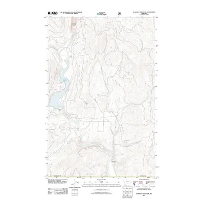
2011 Map of Hubbart Reservoir
USGS Topo · Published 2011About this map
Hubbart Reservoir serves as the central hydrographic feature of this 2011 survey, collecting waters from Tamarack Creek and flowing out past the Hubbart Dam into the Little Bitterroot River. The surrounding landscape is defined by a network of drainage systems including Briggs Creek, Clear Creek, and Little Meadow Creek. Settlement and human activity are sparse, represented by Conrad Camp in the north and the Flathead Sunset Quarry to the south.
Find a feature on this map
16 named features on this map. Tap any name to fly to it.
Don’t see what you’re looking for? This feature index may not catch every label — zoom into the map to look around manually.
Map Details
Editions of this 2011 Hubbart Reservoir Map
This is the sole edition of this map. No revisions or reprints were ever made.
Other maps of this area

1956 · Wallace
USGS Topo · 1:250,000

1957 · Kalispell
USGS Topo · 1:250,000

1960 · Kalispell
USGS Topo · 1:250,000

1960 · Wallace
USGS Topo · 1:250,000

1961 · Kalispell
USGS Topo · 1:250,000
1964 · Haskill Mountain
USGS Topo · 1:24,000

1964 · Mill Pocket Creek
USGS Topo · 1:24,000
1964 · Kofford Ridge
USGS Topo · 1:24,000

1964 · Hubbart Reservoir
USGS Topo · 1:24,000

1964 · Murr Peak
USGS Topo · 1:24,000