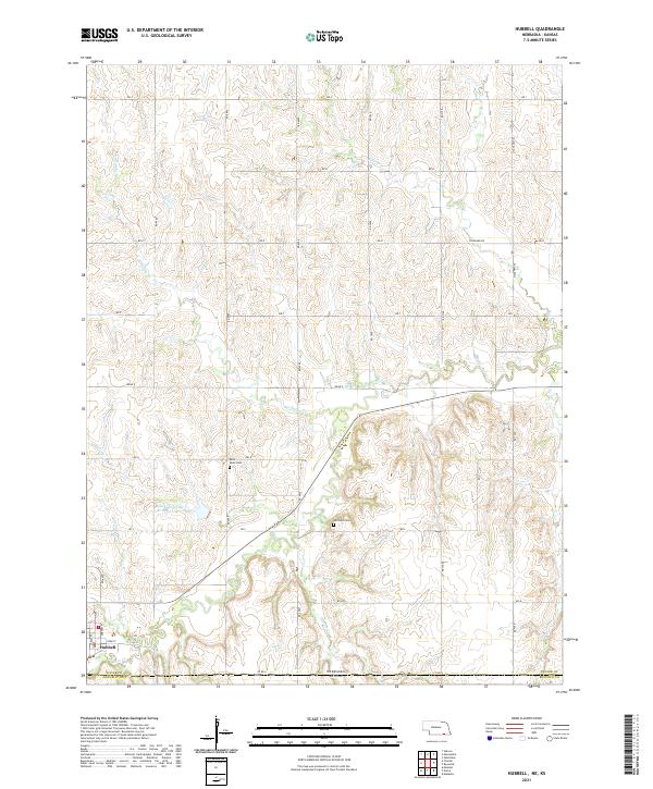
2021 Map of Hubbell
USGS Topo · Published 2021About this map
Hubbell serves as the focal point for this landscape along the border of Thayer County and Republic County. The terrain is defined by a dense network of watercourses, including Rose Cr, Spring Br, and Humphrey Br, which carve out the drainage patterns of the eastern Nebraska plains. This rural expanse is anchored by family and community history, evidenced by Saint Pauls Cem and Williams Cem, providing specific locations for genealogical research and historical study. The village of Hubbell shows a traditional grid with streets like York St and Durham St. A significant hydrological feature, the Bowman-Spring Br Reservoir 2, is located just north of the state line, illustrating local water management strategies in this agricultural region.
Find a feature on this map
30 named features on this map. Tap any name to fly to it.
Don’t see what you’re looking for? This feature index may not catch every label — zoom into the map to look around manually.
Map Details
Editions of this 2021 Hubbell Map
This is the sole edition of this map. No revisions or reprints were ever made.
Other maps of this area

1892 · Concordia
USGS Topo · 1:125,000

1893 · Washington
USGS Topo · 1:125,000

1898 · Hebron
USGS Topo · 1:125,000

1955 · Manhattan
USGS Topo · 1:250,000

1955 · Lincoln
USGS Topo · 1:250,000

1956 · Manhattan
USGS Topo · 1:250,000

1957 · Manhattan
USGS Topo · 1:250,000

1957 · Lincoln
USGS Topo · 1:250,000

1958 · Lincoln
USGS Topo · 1:250,000

1960 · Chester
USGS Topo · 1:24,000