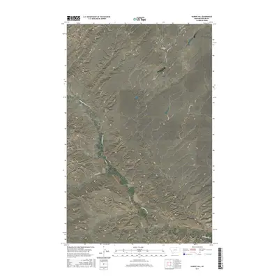
2017 Map of Hubert Hill
USGS Topo · Published 2017About this map
Hubert Hill stands as the central landmark of this Phillips County landscape, rising above a network of seasonal drainages and broad plateaus. The topography is defined by the sharp incisions of coulees, including Alkali Coulee and Joiner Coulee, which carve through the high ground of Emerick Bench and the expansive Hat Flat. This 2017 survey illustrates a sparsely populated region where the land use is primarily shaped by the natural contours of the terrain. Connectivity across the plains is maintained by rural routes such as N Wagner Rd and Wilson Rd, while Cottonwood Cr and Lambing Coulee provide the primary hydrologic framework for the area's drainage systems.
Find a feature on this map
13 named features on this map. Tap any name to fly to it.
Don’t see what you’re looking for? This feature index may not catch every label — zoom into the map to look around manually.
Map Details
Editions of this 2017 Hubert Hill Map
This is the sole edition of this map. No revisions or reprints were ever made.
Other maps of this area

1920 · Avery
USGS Topo · 1:125,000

1920 · Cowan
USGS Topo · 1:125,000

1953 · Havre
USGS Topo · 1:250,000

1954 · Glasgow
USGS Topo · 1:250,000

1957 · Glasgow
USGS Topo · 1:250,000

1957 · Havre
USGS Topo · 1:250,000

1958 · Glasgow
USGS Topo · 1:250,000

1958 · Havre
USGS Topo · 1:250,000

1984 · Chapman
USGS Topo · 1:24,000

1984 · Emerick Bench
USGS Topo · 1:24,000