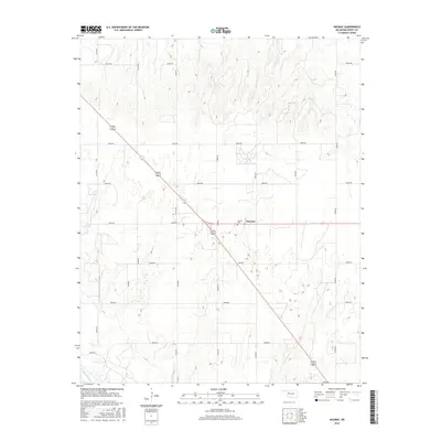
2016 Map of Hucmac
USGS Topo · Published 2016About this map
Hucmac sits at the intersection of local township roads and the diagonal path of a major highway in this 2016 survey of Western Oklahoma. The landscape is defined by the drainage systems of the Canadian River, which cuts across the southwestern corner, and Little Robe Cr to the east. This section of Dewey County exhibits a traditional grid-based settlement pattern, with the interior terrain characterized by numerous small ponds and depressions that dot the prairie between the primary watercourses. Genealogists and local historians will find the Munice Cem as a primary landmark near the central crossroads, serving the rural community that surrounds the modest settlement of Hucmac.
Find a feature on this map
19 named features on this map. Tap any name to fly to it.
Don’t see what you’re looking for? This feature index may not catch every label — zoom into the map to look around manually.
Map Details
Editions of this 2016 Hucmac Map
This is the sole edition of this map. No revisions or reprints were ever made.
Other maps of this area

1955 · Clinton
USGS Topo · 1:250,000

1955 · Woodward
USGS Topo · 1:250,000

1957 · Clinton
USGS Topo · 1:250,000

1958 · Woodward
USGS Topo · 1:250,000

1962 · Putnam
USGS Topo · 1:62,500

1964 · Oakwood
USGS Topo · 1:62,500

1972 · Canton NW
USGS Topo · 1:24,000

1972 · Hucmac
USGS Topo · 1:24,000

1972 · Canton SW
USGS Topo · 1:24,000

1972 · Seiling
USGS Topo · 1:24,000