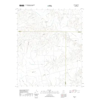
2019 Map of Hudd
USGS Topo · Published 2019About this map
The Double Mountain Fork Brazos River winds through this West Texas landscape where Kent, Scurry, and Fisher Counties converge. In this ranching and rural region, Cottonwood Flat sits near the Cottonwood Flat Cem, serving as a primary point of interest for genealogists and local historians. The terrain is defined by a series of distinctively named formations, from the elevations of Big Gobbler and Little Gobbler to the dramatic cuts of Impossible Canyon and Red Neck Canyon. Several seasonal drainage paths like Goldstens Br and Maverick Cr feed into the river system, while Sugar Loaf stands out at the edge of Longhorn Valley. A network of county roads, including Co RD 1105 and Co RD 1274, connects the scattered landmarks and small cemeteries that mark the area's pioneer history.
Find a feature on this map
28 named features on this map. Tap any name to fly to it.
Don’t see what you’re looking for? This feature index may not catch every label — zoom into the map to look around manually.
Map Details
Editions of this 2019 Hudd Map
This is the sole edition of this map. No revisions or reprints were ever made.
Other maps of this area

1926 · Snyder 1-a
USGS Topo · 1:48,000

1932 · Camp Springs
USGS Topo · 1:62,500

1954 · Lloyd Mountain
USGS Topo · 1:24,000

1954 · Lubbock
USGS Topo · 1:250,000

1954 · Big Spring
USGS Topo · 1:250,000

1958 · Big Spring
USGS Topo · 1:250,000

1969 · Camp Springs
USGS Topo · 1:24,000
1969 · A B C Creek
USGS Topo · 1:24,000

1969 · Maverick Creek
USGS Topo · 1:24,000
1969 · Hudd
USGS Topo · 1:24,000