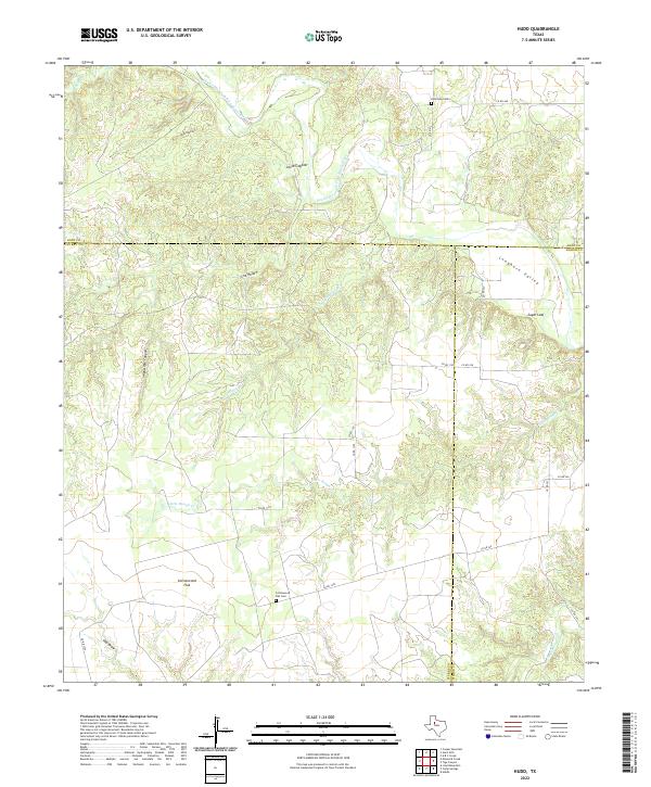
2022 Map of Hudd
USGS Topo · Published 2022About this map
The Double Mountain Fork Brazos River carves a winding path through this corner of West Texas, where the borders of Scurry, Kent, and Fisher counties converge. The terrain is defined by its dramatic breaks and named draws, including the sharply incised Impossible Canyon and the broad drainage of Cox Hollow. This landscape is primarily agricultural and ranch-oriented, with a sparse network of county roads like Co RD 1105 and Co RD 1275 connecting isolated landmarks.
Find a feature on this map
27 named features on this map. Tap any name to fly to it.
Don’t see what you’re looking for? This feature index may not catch every label — zoom into the map to look around manually.
Map Details
Editions of this 2022 Hudd Map
This is the sole edition of this map. No revisions or reprints were ever made.
Other maps of this area

1926 · Snyder 1-a
USGS Topo · 1:48,000

1932 · Camp Springs
USGS Topo · 1:62,500

1954 · Lloyd Mountain
USGS Topo · 1:24,000

1954 · Lubbock
USGS Topo · 1:250,000

1954 · Big Spring
USGS Topo · 1:250,000

1958 · Big Spring
USGS Topo · 1:250,000

1969 · Camp Springs
USGS Topo · 1:24,000
1969 · A B C Creek
USGS Topo · 1:24,000

1969 · Maverick Creek
USGS Topo · 1:24,000
1969 · Hudd
USGS Topo · 1:24,000