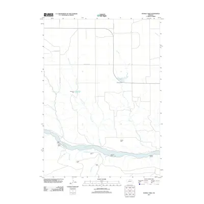
2011 Map of Huddle Table
USGS Topo · Published 2011About this map
The Niobrara River carves through the southern landscape of Keya Paha County, Nebraska, defining a corridor of ranching and irrigation at the turn of the 21st century. Named tablelands and plateaus like Huddle Table overlook a river valley marked by shifting channels and seasonal islands, including Cedar Island and Hartman Island. The area reflects a deeply rooted ranching economy, with family-named operations such as the Johnny Kirkpatrick Ranch, Hurlbut Ranch, and Chase Ranch distributed across the drainage basins. Water management is central to this environment, evidenced by the infrastructure of Cub Creek Dam and Batchelder Dam, which create reservoirs that sustain local agriculture. To the east, the terrain drops into Buzzard Canyon, while various tributaries like Turkey Creek and Chimney Creek feed the main river system, illustrating the vital connection between these highland pastures and the water sources that define their boundaries.
Find a feature on this map
22 named features on this map. Tap any name to fly to it.
Don’t see what you’re looking for? This feature index may not catch every label — zoom into the map to look around manually.
Map Details
Editions of this 2011 Huddle Table Map
This is the sole edition of this map. No revisions or reprints were ever made.
Other maps of this area

1949 · Dutch Creek
USGS Topo · 1:24,000

1950 · Norden
USGS Topo · 1:62,500

1950 · Meadville
USGS Topo · 1:24,000

1950 · Huddle Table
USGS Topo · 1:24,000

1950 · Dutch Creek
USGS Topo · 1:24,000

1950 · Wood Lake
USGS Topo · 1:62,500

1952 · Norden
USGS Topo · 1:62,500

1954 · Ainsworth NW
USGS Topo · 1:24,000

1955 · O'Neill
USGS Topo · 1:250,000

1957 · Valentine
USGS Topo · 1:250,000