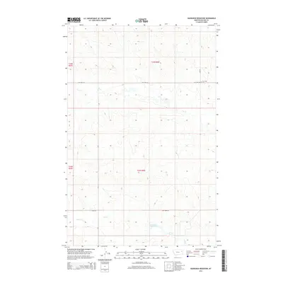
2014 Map of Hudiburgh Reservoir
USGS Topo · Published 2014About this map
Hudiburgh Reservoir and the surrounding drainage basins of McCone County define this prairie landscape in the early 21st century. The map provides a detailed view of the rural infrastructure east of the Big Dry Creek arm of Fort Peck Lake, where a network of gravel and dirt roads like Stoney Rd and N Rd connect isolated ranching sections. Of particular interest to family historians is the Cow Creek Cem, situated near the intersection of Cow Creek Rd and Lbn Rd in the northeastern portion of the quadrangle.
Find a feature on this map
13 named features on this map. Tap any name to fly to it.
Don’t see what you’re looking for? This feature index may not catch every label — zoom into the map to look around manually.
Map Details
Editions of this 2014 Hudiburgh Reservoir Map
This is the sole edition of this map. No revisions or reprints were ever made.
Other maps of this area

1954 · Glendive
USGS Topo · 1:250,000

1957 · Glendive
USGS Topo · 1:250,000

1958 · Glendive
USGS Topo · 1:250,000

1983 · Haynie Reservoir
USGS Topo · 1:24,000

1983 · Hudiburgh Reservoir
USGS Topo · 1:24,000

1983 · Dailey Spring
USGS Topo · 1:24,000

1983 · Hudiburgh Reservoir NW
USGS Topo · 1:24,000

1983 · Buffalo Creek
USGS Topo · 1:24,000

1983 · Beery Reservoir
USGS Topo · 1:24,000
1983 · Lone Pine School
USGS Topo · 1:24,000