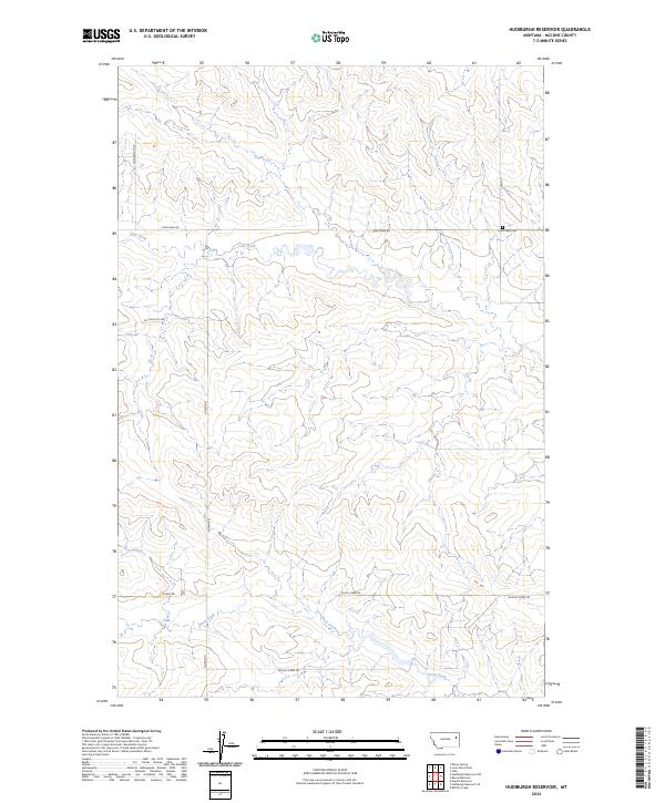
2024 Map of Hudiburgh Reservoir
USGS Topo · Published 2024About this map
Cow Creek and Duck Creek define the drainage patterns of this McCone County landscape, which remains characterized by its remote ranching and industrial infrastructure. The presence of the Oil Field Svc Rd in the western portion of the quadrangle points to the energy sector's footprint in this part of Montana, while a network of rural routes like Cow Creek Rd and North Rd provide access through the dissected terrain. A rare point of genealogical interest is found at the Cow Creek Cem, situated near the junction of L & N Rd and Cow Creek Rd. The map reveals a highly structured division of land under the Public Land Survey System, with township boundaries like t23n r48e and t22n r48e providing the framework for the area's development and resource management.
Find a feature on this map
15 named features on this map. Tap any name to fly to it.
Don’t see what you’re looking for? This feature index may not catch every label — zoom into the map to look around manually.
Map Details
Editions of this 2024 Hudiburgh Reservoir Map
This is the sole edition of this map. No revisions or reprints were ever made.
Other maps of this area

1954 · Glendive
USGS Topo · 1:250,000

1957 · Glendive
USGS Topo · 1:250,000

1958 · Glendive
USGS Topo · 1:250,000

1983 · Haynie Reservoir
USGS Topo · 1:24,000

1983 · Hudiburgh Reservoir
USGS Topo · 1:24,000

1983 · Dailey Spring
USGS Topo · 1:24,000

1983 · Hudiburgh Reservoir NW
USGS Topo · 1:24,000

1983 · Buffalo Creek
USGS Topo · 1:24,000

1983 · Beery Reservoir
USGS Topo · 1:24,000
1983 · Lone Pine School
USGS Topo · 1:24,000