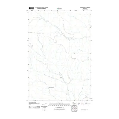
2011 Map of Hudson Creek
USGS Topo · Published 2011About this map
Wenas Camp sits in the high watershed of Yakima County, where the complex drainage systems of the Manastash and Wenas creeks meet. This 2011 survey reveals a landscape defined by its water-carved geography, with the South Fork Manastash Creek and North Fork Manastash Creek dominating the northern reaches. The area is crisscrossed by essential mountain arteries such as Manastash Ridge Rd and Wenas Rd, providing access to distinct natural features like the Mud Flats and the steep contours of Dipping Vat Canyon. To the south, the North Fork Wenas Creek and Dry Creek illustrate the seasonal hydrology of this region, while names like Yellow Jacket Creek and Umtanum Creek highlight the numerous small tributaries that feed the larger river basins. The presence of Game Department Rd indicates the managed natural character of this territory, where remote canyons and ridge-top routes define the movement through the terrain.
Find a feature on this map
17 named features on this map. Tap any name to fly to it.
Don’t see what you’re looking for? This feature index may not catch every label — zoom into the map to look around manually.
Map Details
Editions of this 2011 Hudson Creek Map
This is the sole edition of this map. No revisions or reprints were ever made.
Other maps of this area

1897 · Mount Stuart
USGS Topo · 1:125,000

1899 · Ellensburg
USGS Topo · 1:125,000

1901 · Ellensburg
USGS Topo · 1:125,000

1902 · Mount Stuart
USGS Topo · 1:125,000

1950 · Yakima
USGS Topo · 1:250,000

1957 · Wenatchee
USGS Topo · 1:250,000

1958 · Thorp
USGS Topo · 1:24,000

1958 · Ellensburg
USGS Topo · 1:62,500

1958 · Thorp
USGS Topo · 1:62,500

1958 · Cle Elum
USGS Topo · 1:62,500