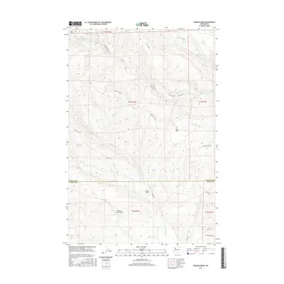
2017 Map of Hudson Creek
USGS Topo · Published 2017About this map
Manastash Ridge dominates the center of this landscape on the border between Kittitas and Yakima Counties, serving as a significant watershed divide. To the north, the headwaters of the S Fork Manastash Cr and N Fork Manastash Cr carve through high terrain, while the southern slopes descend into the Wenas Valley. This area is defined by a network of rural access routes and trails, including the notably named Hog Ranch Rd and Audubon Rd, which navigate the elevation changes near Dipping Vat Canyon. The presence of Mud Flats and numerous seasonal drainages like Dry Cr indicates a complex drainage pattern across the high desert plateau. For local historians and land researchers, the map details the precise alignment of roads such as Game Department Rd and Walter Springs Rd as they existed in 2017.
Find a feature on this map
26 named features on this map. Tap any name to fly to it.
Don’t see what you’re looking for? This feature index may not catch every label — zoom into the map to look around manually.
Map Details
Editions of this 2017 Hudson Creek Map
This is the sole edition of this map. No revisions or reprints were ever made.
Other maps of this area

1897 · Mount Stuart
USGS Topo · 1:125,000

1899 · Ellensburg
USGS Topo · 1:125,000

1901 · Ellensburg
USGS Topo · 1:125,000

1902 · Mount Stuart
USGS Topo · 1:125,000

1950 · Yakima
USGS Topo · 1:250,000

1957 · Wenatchee
USGS Topo · 1:250,000

1958 · Thorp
USGS Topo · 1:24,000

1958 · Ellensburg
USGS Topo · 1:62,500

1958 · Thorp
USGS Topo · 1:62,500

1958 · Cle Elum
USGS Topo · 1:62,500