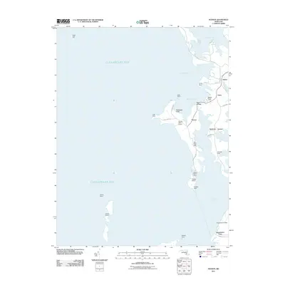
2011 Map of Hudson
USGS Topo · Published 2011About this map
Chesapeake Bay dominates the western half of this maritime landscape, where the intricate shoreline of Dorchester County meets the Little Choptank River. The survey reveals a coastal environment defined by narrow necks and tidal coves, including Hills Point Neck and Casson Neck. Small bayfront communities such as Hudson, Thomas, and James are connected by a network of local roads like Cook Point Rd and Hills Point Rd, which follow the contours of the land to reach isolated points. Private aviation infrastructure is evident at Big Oak Farm Airport and Ragged Island Airport, highlighting the region's reliance on both air and water travel. To the south, James Island and Ragged Island sit offshore, while landmarks like Sharps Island Light and Susquehanna Point serve as critical navigational markers along this highly articulated section of the Maryland coast.
Find a feature on this map
41 named features on this map. Tap any name to fly to it.
Don’t see what you’re looking for? This feature index may not catch every label — zoom into the map to look around manually.
Map Details
Editions of this 2011 Hudson Map
This is the sole edition of this map. No revisions or reprints were ever made.
Other maps of this area

1892 · Drum Point
USGS Topo · 1:62,500

1893 · Sharps Island
USGS Topo · 1:62,500

1898 · Choptank
USGS Topo · 1:125,000

1898 · St. Marys
USGS Topo · 1:125,000

1901 · Drum Point
USGS Topo · 1:62,500

1904 · Sharps Island
USGS Topo · 1:62,500

1904 · Oxford
USGS Topo · 1:62,500

1905 · Crapo
USGS Topo · 1:62,500

1905 · Drum Point
USGS Topo · 1:62,500

1906 · St. Marys
USGS Topo · 1:125,000