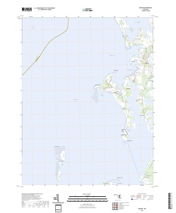
2023 Map of Hudson
USGS Topo · Published 2023About this map
Dorchester County's intricate shoreline along the Chesapeake Bay is defined by a series of low-lying peninsulas and protected coves. In the contemporary landscape, small settlements like Hudson and Thomas serve as anchors for a network of rural roads such as Hudson Rd and Hills Point Rd. The map illustrates the fragile geography of the Eastern Shore, where features like James Island and Ragged Island stand separated from the mainland by narrow reaches of water. Genealogical value is found in the preservation of small family-named sites, including the Spedden Seward Cem and Dail Farm Cem. Local aviation is also present through private facilities like Big Oak Farm Airport and the Ragged Island Airport. This 2023 survey provides a clear view of the complex land-water interface at Casson Neck and Hills Point Neck, where the terrain remains deeply tied to the rhythms of Trippe Bay and Brannock Bay.
Find a feature on this map
40 named features on this map. Tap any name to fly to it.
Don’t see what you’re looking for? This feature index may not catch every label — zoom into the map to look around manually.
Map Details
Editions of this 2023 Hudson Map
This is the sole edition of this map. No revisions or reprints were ever made.
Other maps of this area

1892 · Drum Point
USGS Topo · 1:62,500

1893 · Sharps Island
USGS Topo · 1:62,500

1898 · Choptank
USGS Topo · 1:125,000

1898 · St. Marys
USGS Topo · 1:125,000

1901 · Drum Point
USGS Topo · 1:62,500

1904 · Sharps Island
USGS Topo · 1:62,500

1904 · Oxford
USGS Topo · 1:62,500

1905 · Crapo
USGS Topo · 1:62,500

1905 · Drum Point
USGS Topo · 1:62,500

1906 · St. Marys
USGS Topo · 1:125,000