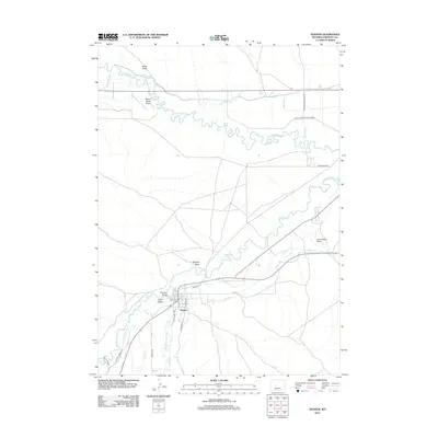
2012 Map of Hudson
USGS Topo · Published 2012About this map
The confluence of the Popo Agie River and the Little Wind River anchors this landscape in Fremont County, where a complex network of irrigation infrastructure supports the high desert valley. The settlement of Hudson sits near the junction of these waterways, organized along a traditional grid with streets such as S Oklahoma Ave and W 4th St. This area's agricultural history is written in its water management, including the Sub-Agency Ditch, Wise DITCH, and Big Corral Ditch, which redirect flow across the terrain to sustain local ranching and farming operations.
Find a feature on this map
31 named features on this map. Tap any name to fly to it.
Don’t see what you’re looking for? This feature index may not catch every label — zoom into the map to look around manually.
Map Details
Editions of this 2012 Hudson Map
This is the sole edition of this map. No revisions or reprints were ever made.
Other maps of this area

1951 · Mule Butte
USGS Topo · 1:24,000

1951 · Pavillion SE
USGS Topo · 1:24,000

1951 · Riverton West
USGS Topo · 1:24,000

1952 · Hudson
USGS Topo · 1:24,000

1952 · Lander SE
USGS Topo · 1:24,000

1952 · Lander
USGS Topo · 1:24,000

1952 · Lander NW
USGS Topo · 1:24,000

1953 · Ninemile Hill
USGS Topo · 1:24,000

1953 · Arapahoe
USGS Topo · 1:24,000

1955 · Thermopolis
USGS Topo · 1:250,000