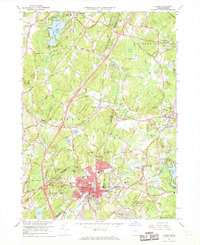
1966 Map of Hudson
USGS Topo · Published 1968About this map
The Assabet River winds through the heart of Hudson, Massachusetts, anchoring a landscape defined by its industrial village centers and diverse topography during the mid-1960s. This survey illustrates the concentrated development along the Boston and Maine Railroad, which connected the textile mills and factories of Gleasondale and central Hudson to the broader New England corridor. To the north, the terrain transitions into the more agrarian and wooded character of Bolton and Harvard, where Bare Hill Pond and its small islands like Spectacle Island serve as significant local landmarks.
Find a feature on this map
179 named features on this map. Tap any name to fly to it.
Don’t see what you’re looking for? This feature index may not catch every label — zoom into the map to look around manually.
Map Details
Editions of this 1966 Hudson Map
2 editions found
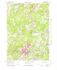
Other maps of this area

1886 · Lowell
USGS Topo · 1:62,500

1886 · Framingham
USGS Topo · 1:62,500

1887 · Marlboro
USGS Topo · 1:62,500

1889 · Marlboro
USGS Topo · 1:62,500

1889 · Framingham
USGS Topo · 1:62,500

1893 · Lowell
USGS Topo · 1:62,500

1893 · Groton
USGS Topo · 1:62,500

1894 · Framingham
USGS Topo · 1:62,500

1896 · Marlboro
USGS Topo · 1:62,500

1898 · Marlboro
USGS Topo · 1:62,500