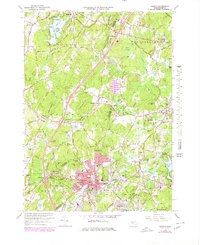
1966 Map of Hudson
USGS Topo · Published 1979About this map
The Assabet River winds through the heart of this landscape, anchoring the industrial and civic center of Hudson. At this time, the town's dense residential core is defined by a concentration of educational and municipal institutions, including the Harriman Sch, Kennedy Jr High Sch, and the Townhall. The surrounding terrain transitions into more rural reaches of Bolton and Stow, where topographic heights like Rattlesnake Hill and Wataquadock Hill overlook small settlements such as Gleasondale and East Berlin.
Find a feature on this map
158 named features on this map. Tap any name to fly to it.
Don’t see what you’re looking for? This feature index may not catch every label — zoom into the map to look around manually.
Map Details
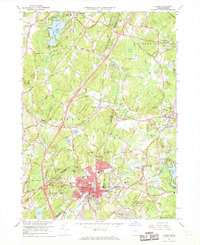
Editions of this 1966 Hudson Map
2 editions found
Other maps of this area

1886 · Lowell
USGS Topo · 1:62,500

1886 · Framingham
USGS Topo · 1:62,500

1887 · Marlboro
USGS Topo · 1:62,500

1889 · Marlboro
USGS Topo · 1:62,500

1889 · Framingham
USGS Topo · 1:62,500

1893 · Lowell
USGS Topo · 1:62,500

1893 · Groton
USGS Topo · 1:62,500

1894 · Framingham
USGS Topo · 1:62,500

1896 · Marlboro
USGS Topo · 1:62,500

1898 · Marlboro
USGS Topo · 1:62,500