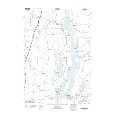
2013 Map of Hudson North
USGS Topo · Published 2013About this map
The Hudson River corridor defines this landscape at the border of Greene and Columbia counties, where historic riverfront settlements like Coxsackie and Athens anchor the western shore. The map illustrates a complex riparian environment of mudflats and islands, including Middle Ground Flats and Stockport Middle Ground, alongside navigational markers such as Fourmile Point and Priming Hook. Inland, the terrain rises toward Lampman Hill and Flint Mine Hill, with residential developments centered around Sleepy Hollow Lake.
Find a feature on this map
186 named features on this map. Tap any name to fly to it.
Don’t see what you’re looking for? This feature index may not catch every label — zoom into the map to look around manually.
Map Details
Editions of this 2013 Hudson North Map
This is the sole edition of this map. No revisions or reprints were ever made.
Other maps of this area

1893 · Coxsackie
USGS Topo · 1:62,500

1894 · Coxsackie
USGS Topo · 1:62,500

1895 · Catskill
USGS Topo · 1:62,500

1902 · Copake
USGS Topo · 1:62,500

1903 · Kinderhook
USGS Topo · 1:62,500

1904 · Copake
USGS Topo · 1:62,500

1929 · Coxsackie
USGS Topo · 1:62,500

1933 · Kinderhook
USGS Topo · 1:62,500

1934 · Catskill
USGS Topo · 1:62,500

1938 · Catskill
USGS Topo · 1:62,500