
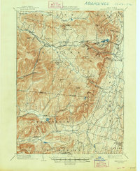
2023 Map of Hudson North
USGS Topo · Published 2023About this map
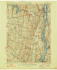
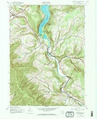
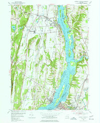
The Hudson River corridor serves as the central spine of this landscape, dividing the riverfront communities of Athens and Coxsackie from their eastern neighbors like Stottville and Columbiaville. This modern survey illustrates a mix of industrial river legacy and residential development, most notably the significant footprint of Sleepy Hollow Lake and its surrounding community. Local genealogy and history are well-preserved through several family and community burial grounds, including the Armstrong Family Cem and Hallenbeck Cem. Historic landmarks like the Bronck House and the Columbia County Courthouse in Hudson remain prominent anchors. The river itself is dotted with complex shoreline features such as Rattlesnake Island, Nutten Hook, and Middle Ground Flats, reflecting the shifting character of the Hudson's tidal reaches.
Find a feature on this map
170 named features on this map. Tap any name to fly to it.
Don’t see what you’re looking for? This feature index may not catch every label — zoom into the map to look around manually.
Map Details
Editions of this 2023 Hudson North Map
This is the sole edition of this map. No revisions or reprints were ever made.
Historical Maps of Newton Hook Through Time
40 maps found
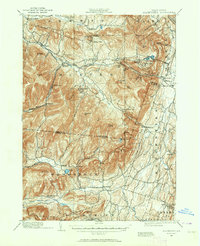
1892 Kaaterskill
Greene County, NY

1893 Coxsackie
Greene County, NY

1893 Durham
Greene County, NY

1893 Kaaterskill
Greene County, NY

1894 Coxsackie
Greene County, NY
1894 Durham
Greene County, NY

1894 Kaaterskill
Greene County, NY
1899 Kaaterskill
Greene County, NY
1903 Kaaterskill
Greene County, NY
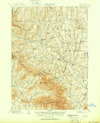
1929 Coxsackie
Greene County, NY
1943 Freehold
Greene County, NY
1945 Ashland
Greene County, NY

1945 Freehold
Greene County, NY

1945 Hensonville
Greene County, NY
1945 Hunter
Greene County, NY
1945 Prattsville
Greene County, NY

1946 Ashland
Greene County, NY
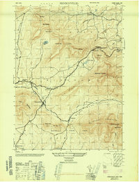
1946 Hensonville
Greene County, NY

1946 Hunter
Greene County, NY
1946 Kaaterskill
Greene County, NY

1946 Lexington
Greene County, NY

1946 Prattsville
Greene County, NY
1953 Alcove
Greene County, NY
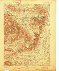
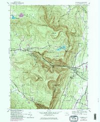
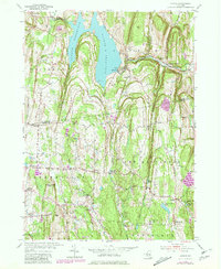
1953 Hudson North
Greene County, NY
1960 Lexington
Greene County, NY

1978 Wilmington
Greene County, NY
1980 Hensonville
Greene County, NY

1980 Hudson North
Greene County, NY

1980 Hunter
Greene County, NY

1997 Hunter
Greene County, NY

1997 Kaaterskill Clove
Greene County, NY

2023 Alcove
Greene County, NY

2023 Ashland
Greene County, NY

2023 Freehold
Greene County, NY

2023 Hensonville
Greene County, NY
2023 Hudson North
Greene County, NY

2023 Hunter
Greene County, NY

2023 Kaaterskill Clove
Greene County, NY

2023 Lexington
Greene County, NY

2023 Prattsville
Greene County, NY