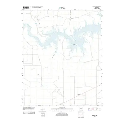
2010 Map of Hudson
USGS Topo · Published 2010About this map
Ute Reservoir dominates the northern landscape of this Quay County region, where the Canadian River was impounded to create a sprawling water source in the high desert. The map captures an era of agricultural management, evidenced by the Hudson Lateral irrigation canal and a network of named ranching sites and small rural localities. Small settlement nodes such as Hudson, Favor, and Dowell are connected by a rigid grid of Quay County roads. The terrain is marked by seasonal drainage features like Romero Draw and Cow Springs Draw, while landmarks like Watson Island and Simms Ranch provide specific points of interest for those tracing the modern footprint of these historic ranching lands.
Find a feature on this map
29 named features on this map. Tap any name to fly to it.
Don’t see what you’re looking for? This feature index may not catch every label — zoom into the map to look around manually.
Map Details
Editions of this 2010 Hudson Map
This is the sole edition of this map. No revisions or reprints were ever made.
Other maps of this area

1930 · Tucumcari
USGS Topo · 1:125,000

1954 · Tucumcari
USGS Topo · 1:250,000

1958 · Tucumcari
USGS Topo · 1:250,000

1962 · Logan
USGS Topo · 1:62,500

1967 · Tucumcari
USGS Topo · 1:24,000

1968 · Bascom Camp
USGS Topo · 1:24,000

1968 · Hampton Ranch
USGS Topo · 1:24,000

1968 · Hudson
USGS Topo · 1:24,000

1968 · San Jon NW
USGS Topo · 1:24,000

1968 · Lesbia
USGS Topo · 1:24,000