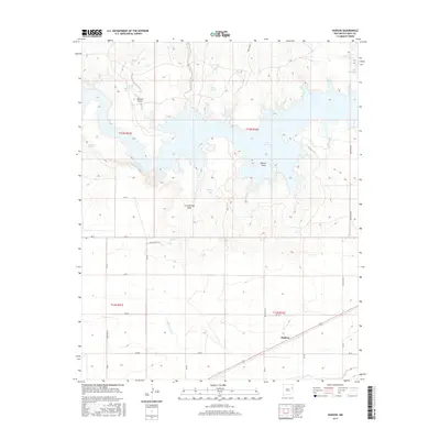
2017 Map of Hudson
USGS Topo · Published 2017About this map
Hudson and the expansive waters of the Ute Reservoir dominate this eastern New Mexico landscape, where the Canadian River valley meets the high plains of Quay County. The reservoir's shoreline is defined by numerous inlets and the prominent Watson Island, reflecting the 20th-century water management efforts that transformed this semi-arid region. Surrounding the water, a network of traditional ranching and irrigation landmarks persists, including family-named features like Romero Draw and several water sources such as Burr Springs and Dripping Springs. South of the lake, the Hudson Lateral canal cuts through the terrain, illustrating the critical infrastructure used to support local agriculture. The map also traces a dense grid of rural roads, such as Quay Road AE and Quay Road AI, which connect scattered ranch tanks like Ochenta Tank and Willow Tank across the mesas.
Find a feature on this map
32 named features on this map. Tap any name to fly to it.
Don’t see what you’re looking for? This feature index may not catch every label — zoom into the map to look around manually.
Map Details
Editions of this 2017 Hudson Map
This is the sole edition of this map. No revisions or reprints were ever made.
Other maps of this area

1930 · Tucumcari
USGS Topo · 1:125,000

1954 · Tucumcari
USGS Topo · 1:250,000

1958 · Tucumcari
USGS Topo · 1:250,000

1962 · Logan
USGS Topo · 1:62,500

1967 · Tucumcari
USGS Topo · 1:24,000

1968 · Bascom Camp
USGS Topo · 1:24,000

1968 · Hampton Ranch
USGS Topo · 1:24,000

1968 · Hudson
USGS Topo · 1:24,000

1968 · San Jon NW
USGS Topo · 1:24,000

1968 · Lesbia
USGS Topo · 1:24,000