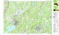
1988 Map of Hudson
USGS Topo · Published 1988About this map
The Nashua River winds through this central Massachusetts corridor, anchoring a landscape where the industrial heritage of Clinton and Hudson meets the institutional presence of the Fort Devens Military Reservation. In the south, the massive Wachusett Reservoir dominates the terrain, its waters bordering Cemetery Island and Greenhalge Point. The map captures a moment in the late 20th century where traditional town centers like Lancaster and Bolton remain distinct amidst evolving suburban infrastructure and the Boston and Maine rail lines.
Find a feature on this map
128 named features on this map. Tap any name to fly to it.
Don’t see what you’re looking for? This feature index may not catch every label — zoom into the map to look around manually.
Map Details
Editions of this 1988 Hudson Map
2 editions found
Other maps of this area

1885 · Worcester
USGS Topo · 1:62,500

1886 · Worcester
USGS Topo · 1:62,500

1886 · Lowell
USGS Topo · 1:62,500

1886 · Framingham
USGS Topo · 1:62,500

1887 · Marlboro
USGS Topo · 1:62,500

1887 · Fitchburg
USGS Topo · 1:62,500

1889 · Marlboro
USGS Topo · 1:62,500

1889 · Fitchburg
USGS Topo · 1:62,500

1889 · Framingham
USGS Topo · 1:62,500

1892 · Worcester
USGS Topo · 1:62,500