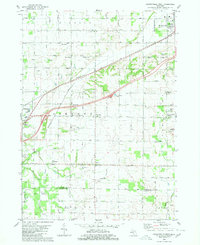
1980 Map of Hudsonville West
USGS Topo · Published 1980About this map
The Dutch-influenced farming communities of Ottawa and Allegan counties are captured in detail during the late 1970s. The landscape is defined by its agricultural grid, where small settlements like Beaverdam, Vriesland, and Drenthe serve as local hubs. These towns are frequently anchored by their cemeteries and churches, such as the Vriesland Ch and East Drenthe Cem, which remain vital landmarks for genealogical research. The Chesapeake and Ohio railroad cuts diagonally across the township lines of Blendon and Zeeland, paralleling the modern highway system that was expanding the reach of nearby Hudsonville. Industrial elements are also present, including numerous Gas Wells and a large Gas Storage Area in the south near Salem, reflecting the region's underlying natural resources alongside its traditional agrarian character. Waterways like the Macatawa River and Black Creek provide natural drainage through this developed terrain.
Find a feature on this map
53 named features on this map. Tap any name to fly to it.
Don’t see what you’re looking for? This feature index may not catch every label — zoom into the map to look around manually.
Map Details
Editions of this 1980 Hudsonville West Map
This is the sole edition of this map. No revisions or reprints were ever made.
Other maps of this area

1928 · Fennville
USGS Topo · 1:62,500

1929 · Holland
USGS Topo · 1:62,500

1931 · Fennville
USGS Topo · 1:62,500

1932 · Holland
USGS Topo · 1:62,500

1958 · Allendale
USGS Topo · 1:24,000

1958 · Allegan
USGS Topo · 1:62,500

1958 · Grandville
USGS Topo · 1:62,500

1958 · Grandville
USGS Topo · 1:24,000

1958 · Racine
USGS Topo · 1:250,000

1958 · Grand Rapids
USGS Topo · 1:250,000