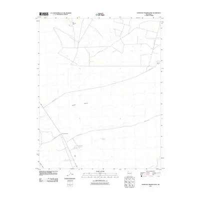
2010 Map of Huerfano Trading Post
USGS Topo · Published 2010About this map
Huerfano Trading Post sits as a central landmark in this high-desert landscape of the Eastern Navajo Agency, positioned near the intersection of several significant local thoroughfares. The terrain is defined by the prominent Huerfano Mountain and the drainage patterns of Gallegos Canyon, reflecting the arid geography of San Juan County. Transportation and infrastructure are vital components of this quadrangle, highlighted by the EPNG RR Camp in the northeast and a network of Bureau of Indian Affairs and local roads, including Indian Service Route 7023. The presence of the Ben Detention Dam indicates the importance of water management in this environment. This survey captures a moment when traditional trading outposts and industrial camps existed alongside modern county routes, providing a detailed record of land use and settlement in the Four Corners region during the early twenty-first century.
Find a feature on this map
10 named features on this map. Tap any name to fly to it.
Don’t see what you’re looking for? This feature index may not catch every label — zoom into the map to look around manually.
Map Details
Editions of this 2010 Huerfano Trading Post Map
This is the sole edition of this map. No revisions or reprints were ever made.
Other maps of this area

1889 · Largo
USGS Topo · 1:250,000

1895 · Largo
USGS Topo · 1:250,000

1954 · Aztec
USGS Topo · 1:250,000

1958 · Aztec
USGS Topo · 1:250,000

1959 · Gould Pass
USGS Topo · 1:62,500

1959 · Nageezi
USGS Topo · 1:62,500

1960 · Bloomfield
USGS Topo · 1:62,500

1962 · Aztec
USGS Topo · 1:250,000

1965 · Aztec
USGS Topo · 1:250,000
1966 · Huerfano Trading Post SW
USGS Topo · 1:24,000
Featured Places
- Eastern Navajo Agency, NM
- Huerfano Trading Post, NM
- Dzilth-Na-O-Dith-Hle, NM
- San Juan County, NM
- United States