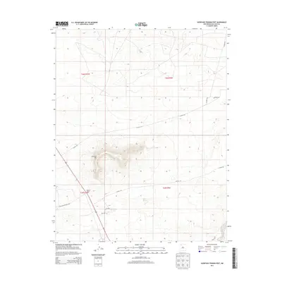
2013 Map of Huerfano Trading Post
USGS Topo · Published 2013About this map
Huerfano Trading Post anchors this high-desert landscape in the Eastern Navajo Agency, positioned at a critical junction of local transportation routes. The prominent geological landmark Huerfano Mtn rises sharply in the center of the sheet, providing a primary point of orientation for the surrounding plateau. A network of rural arteries, including Co Road 7425 and Co Road 7575, connects the sparse settlements and grazing lands characteristic of this part of San Juan County. The inclusion of Indian Service Route 7023 highlights the essential infrastructure managed by the Bureau of Indian Affairs during this period. The map's layout, divided by the township and range lines of t26n r10w and t25n r9w, illustrates the systematic organization of land in the New Mexico backcountry during the early 21st century.
Find a feature on this map
13 named features on this map. Tap any name to fly to it.
Don’t see what you’re looking for? This feature index may not catch every label — zoom into the map to look around manually.
Map Details
Editions of this 2013 Huerfano Trading Post Map
This is the sole edition of this map. No revisions or reprints were ever made.
Other maps of this area

1889 · Largo
USGS Topo · 1:250,000

1895 · Largo
USGS Topo · 1:250,000

1954 · Aztec
USGS Topo · 1:250,000

1958 · Aztec
USGS Topo · 1:250,000

1959 · Gould Pass
USGS Topo · 1:62,500

1959 · Nageezi
USGS Topo · 1:62,500

1960 · Bloomfield
USGS Topo · 1:62,500

1962 · Aztec
USGS Topo · 1:250,000

1965 · Aztec
USGS Topo · 1:250,000
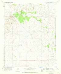
1966 · Huerfano Trading Post SW
USGS Topo · 1:24,000
Featured Places
- Eastern Navajo Agency, NM
- Huerfano Trading Post, NM
- Dzilth-Na-O-Dith-Hle, NM
- San Juan County, NM
- United States