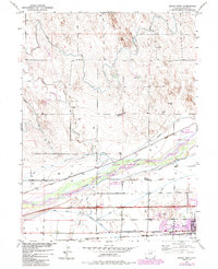
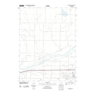
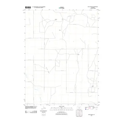
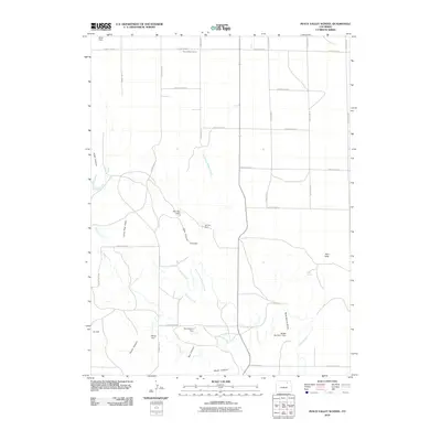
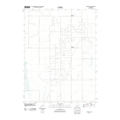
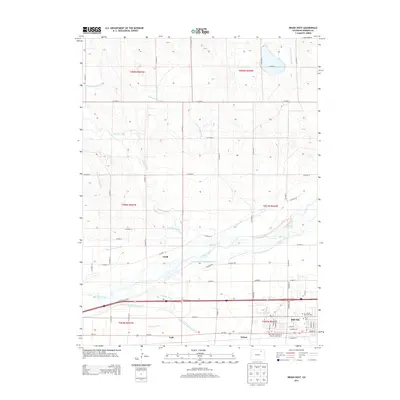
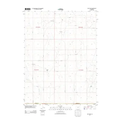
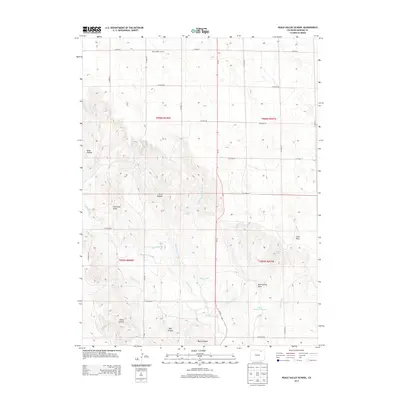
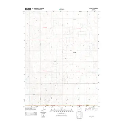
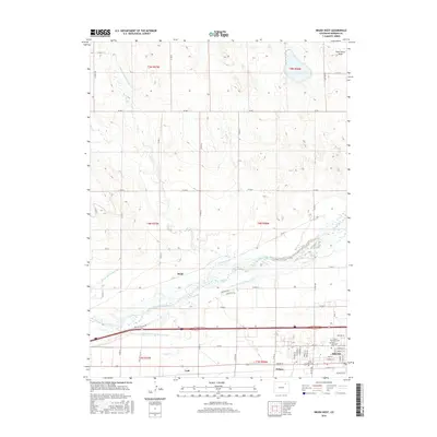
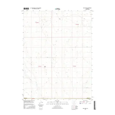
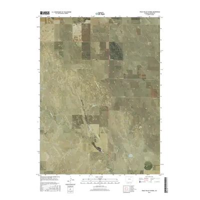
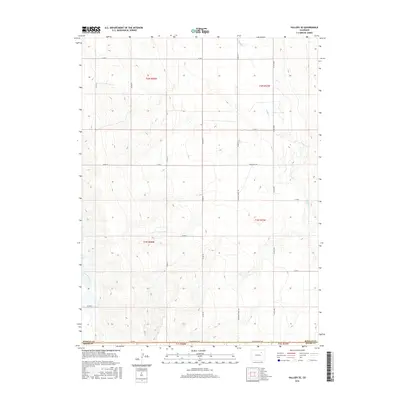
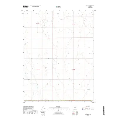
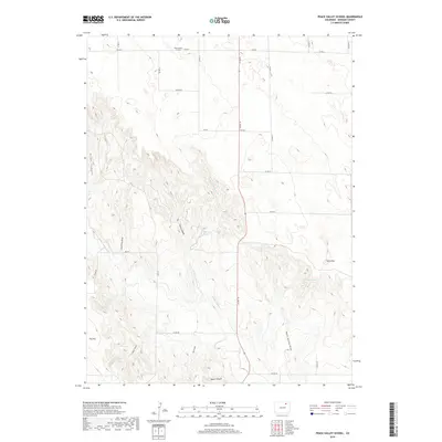
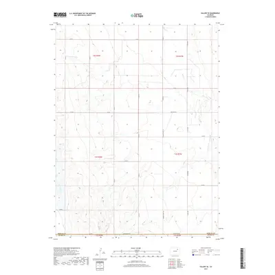
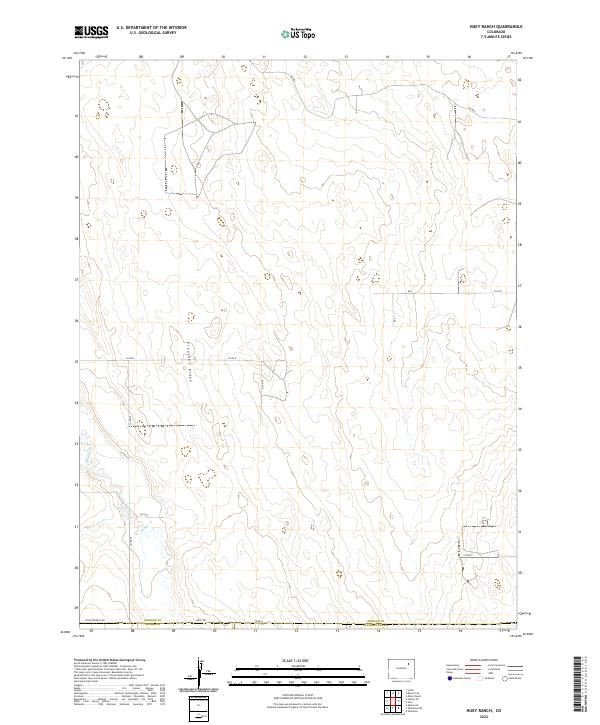
1965 Map of Huey Ranch
USGS Topo · Published 1984About this map
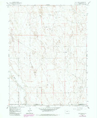
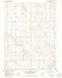
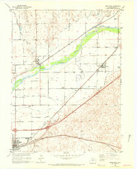
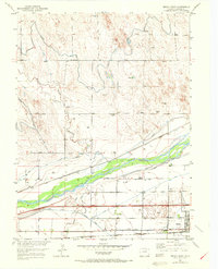
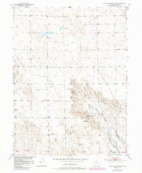
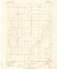
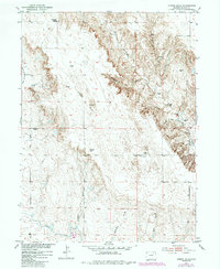
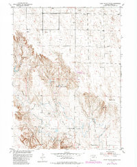
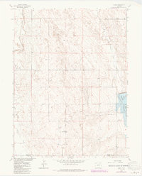
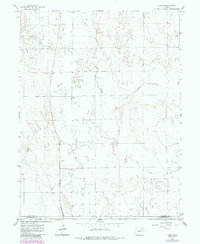
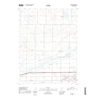
The high plains of eastern Colorado are defined by a sparse ranching and energy-producing landscape on this 1965 survey, updated through the early 1980s. Ranching hubs like Huey Ranch and Redless Ranch anchor the territory, while the Sand River Oil Field in the southeast indicates the region's industrial footprint. The terrain is marked by the modest relief of Pleasant Ridge and the winding course of Badger Creek, which is paralleled by Badger Creek Road. Water access in this arid environment is highlighted by infrastructure such as the Toyne Windmill and Windbreak Windmill. This map captures a moment of transition where traditional cattle operations existed alongside a growing network of petroleum extraction and a high-pressure Pipeline, cutting diagonally across the prairie through the small locality of Frazier.
Find a feature on this map
17 named features on this map. Tap any name to fly to it.
Don’t see what you’re looking for? This feature index may not catch every label — zoom into the map to look around manually.
Map Details
Editions of this 1965 Huey Ranch Map
3 editions found
Historical Maps of Adams County Through Time
99 maps found
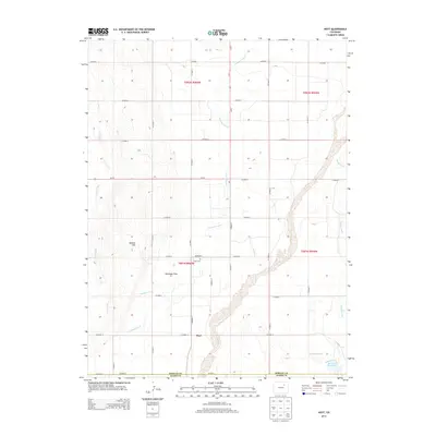
1950 Hoyt
Morgan County, CO
1951 Antelope Springs
Morgan County, CO
1951 Brush East
Morgan County, CO
1951 Brush West
Morgan County, CO
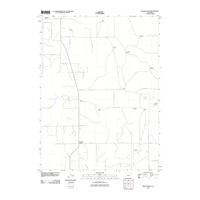
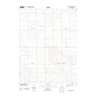
1951 Dead Horse Springs
Morgan County, CO
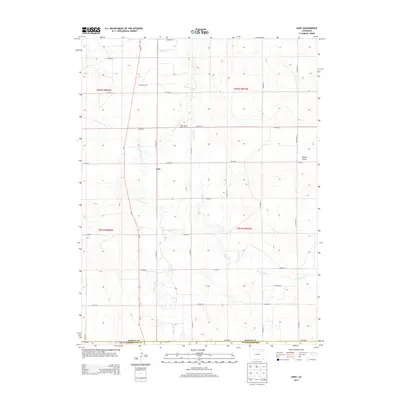
1951 Hoyt
Morgan County, CO
1951 Judson Hills
Morgan County, CO
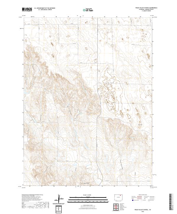
1951 Peace Valley School
Morgan County, CO
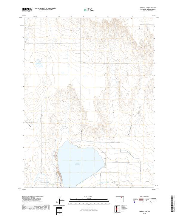
1951 Sunken Lake
Morgan County, CO
1963 Adena
Morgan County, CO
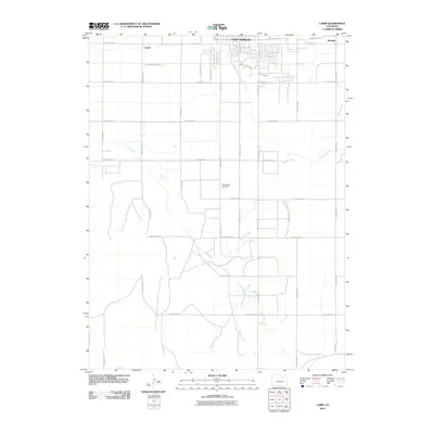
1963 Lamb
Morgan County, CO
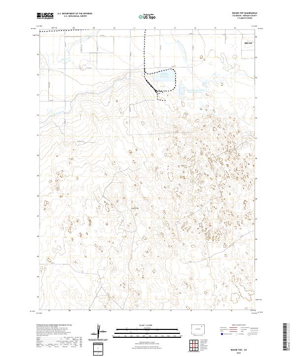
1963 Round Top
Morgan County, CO
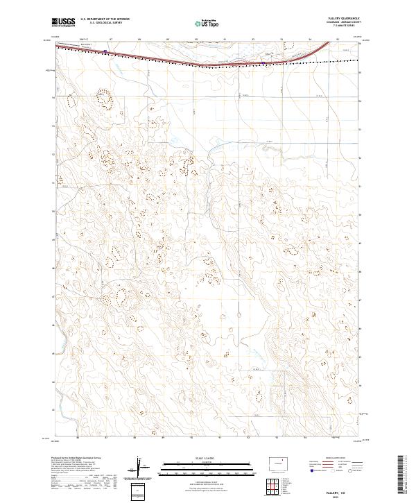
1963 Vallery
Morgan County, CO
1965 Gary
Morgan County, CO
1965 Huey Ranch
Morgan County, CO
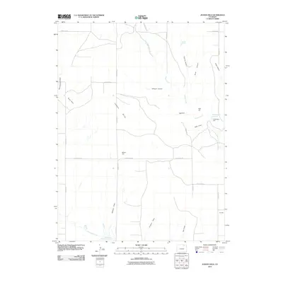
1965 Miller Ranch
Morgan County, CO
1965 Vallery SE
Morgan County, CO
1971 Brush East
Morgan County, CO
1971 Brush West
Morgan County, CO
2010 Adena
Morgan County, CO
2010 Antelope Springs
Morgan County, CO
2010 Brush East
Morgan County, CO
2010 Brush West
Morgan County, CO
2010 Dead Horse Springs
Morgan County, CO
2010 Gary
Morgan County, CO
2010 Hoyt
Morgan County, CO
2010 Huey Ranch
Morgan County, CO
2010 Judson Hills
Morgan County, CO
2010 Lamb
Morgan County, CO
2010 Miller Ranch
Morgan County, CO
2010 Peace Valley School
Morgan County, CO
2010 Round Top
Morgan County, CO
2010 Sunken Lake
Morgan County, CO
2010 Vallery
Morgan County, CO
2010 Vallery SE
Morgan County, CO
2013 Adena
Morgan County, CO
2013 Antelope Springs
Morgan County, CO
2013 Brush East
Morgan County, CO
2013 Brush West
Morgan County, CO
2013 Dead Horse Springs
Morgan County, CO
2013 Gary
Morgan County, CO
2013 Hoyt
Morgan County, CO
2013 Huey Ranch
Morgan County, CO
2013 Judson Hills
Morgan County, CO
2013 Lamb
Morgan County, CO
2013 Miller Ranch
Morgan County, CO
2013 Peace Valley School
Morgan County, CO
2013 Round Top
Morgan County, CO
2013 Sunken Lake
Morgan County, CO
2013 Vallery
Morgan County, CO
2013 Vallery SE
Morgan County, CO
2016 Adena
Morgan County, CO
2016 Antelope Springs
Morgan County, CO
2016 Brush East
Morgan County, CO
2016 Brush West
Morgan County, CO
2016 Dead Horse Springs
Morgan County, CO
2016 Gary
Morgan County, CO
2016 Hoyt
Morgan County, CO
2016 Huey Ranch
Morgan County, CO
2016 Judson Hills
Morgan County, CO
2016 Lamb
Morgan County, CO
2016 Miller Ranch
Morgan County, CO
2016 Peace Valley School
Morgan County, CO
2016 Round Top
Morgan County, CO
2016 Sunken Lake
Morgan County, CO
2016 Vallery
Morgan County, CO
2016 Vallery SE
Morgan County, CO
2019 Adena
Morgan County, CO
2019 Antelope Springs
Morgan County, CO
2019 Brush East
Morgan County, CO
2019 Brush West
Morgan County, CO
2019 Dead Horse Springs
Morgan County, CO
2019 Gary
Morgan County, CO
2019 Hoyt
Morgan County, CO
2019 Huey Ranch
Morgan County, CO
2019 Judson Hills
Morgan County, CO
2019 Lamb
Morgan County, CO
2019 Miller Ranch
Morgan County, CO
2019 Peace Valley School
Morgan County, CO
2019 Round Top
Morgan County, CO
2019 Sunken Lake
Morgan County, CO
2019 Vallery
Morgan County, CO
2019 Vallery SE
Morgan County, CO
2022 Adena
Morgan County, CO
2022 Antelope Springs
Morgan County, CO
2022 Brush East
Morgan County, CO
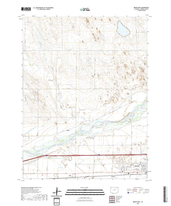
2022 Brush West
Morgan County, CO
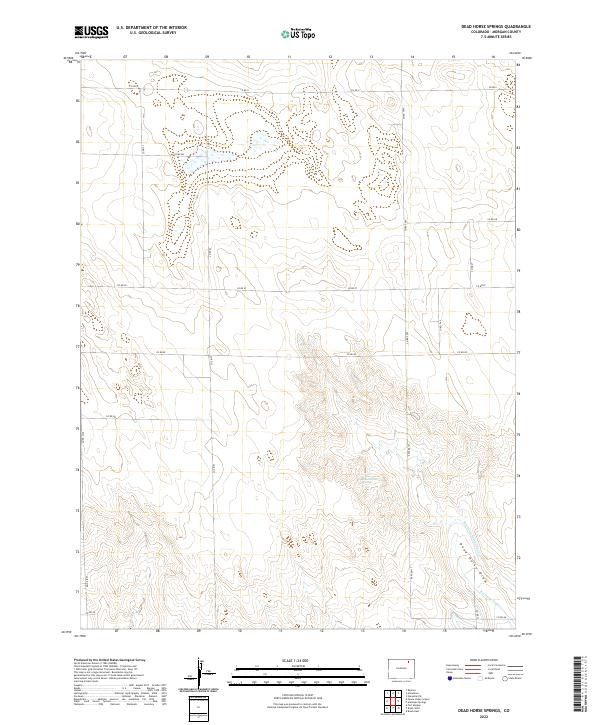
2022 Dead Horse Springs
Morgan County, CO
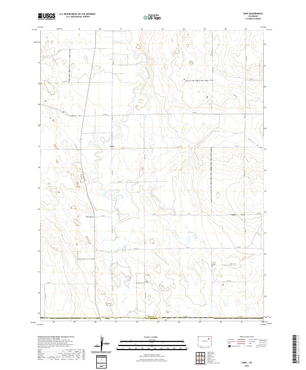
2022 Gary
Morgan County, CO
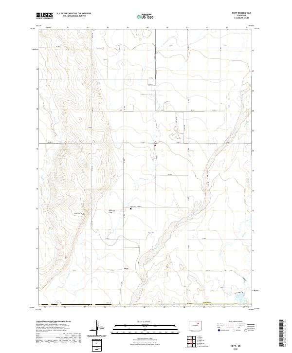
2022 Hoyt
Morgan County, CO
2022 Huey Ranch
Morgan County, CO
2022 Judson Hills
Morgan County, CO
2022 Lamb
Morgan County, CO
2022 Miller Ranch
Morgan County, CO
2022 Peace Valley School
Morgan County, CO
2022 Round Top
Morgan County, CO
2022 Sunken Lake
Morgan County, CO
2022 Vallery
Morgan County, CO
2022 Vallery SE
Morgan County, CO