
1920 Map of Huffman
USGS Topo · Published 1920About this map
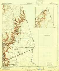
The East Fork San Jacinto River and its intricate network of tributary gullies define this 1916 survey of the coastal prairie and riparian woodlands northeast of Houston. The small settlement of Huffman serves as a central point, situated where the Sour Lake Road meets the Beaumont and Western Road. The landscape is etched with local family and place-named features like John Young Gully, Shook Gully, and Red Gully, which cut deep drainage patterns toward Luce Bayou. A notable industrial presence is the Lumber R R, which winds through the northern timberlands near Scott Ranch, illustrating the importance of the logging industry to the regional economy during this era. The presence of Ferry Road near the river indicates established crossing points before modern bridging, while Cedar Bayou marks the transition toward the neighboring county boundary.
Find a feature on this map
16 named features on this map. Tap any name to fly to it.
Don’t see what you’re looking for? This feature index may not catch every label — zoom into the map to look around manually.
Map Details
Editions of this 1920 Huffman Map
2 editions found
Other maps of this area

1916 · Crosby
USGS Topo · 1:24,000

1916 · Harmaston
USGS Topo · 1:24,000

1916 · Moonshine Hill
USGS Topo · 1:24,000

1916 · Huffman
USGS Topo · 1:24,000

1919 · Crosby
USGS Topo · 1:31,680

1920 · Harmaston
USGS Topo · 1:31,680

1920 · Moonshine Hill
USGS Topo · 1:31,680

1943 · Liberty
USGS Topo · 1:125,000
1944 · Crosby
USGS Topo · 1:31,680
1944 · Harmaston
USGS Topo · 1:31,680