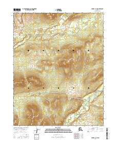
2016 Map of Hughes C-3 SW
USGS Topo · Published 2016About this map
Hogatza River winds through the southeastern portion of this terrain, marking a low-lying drainage system that defines the local hydrology. This interior Alaskan landscape is characterized by significant elevation changes, with several prominent ridges rising sharply above the river valley. In the southwest corner, the Gukhana Cr carves a narrow path through the upland, illustrating the classic dendritic drainage patterns of the region. The map primarily documents the natural topography and township divisions including t14n r21e and t13n r20e, offering a clear view of the wilderness before any significant modern road infrastructure or permanent settlements were established in this specific quadrant.
Find a feature on this map
6 named features on this map. Tap any name to fly to it.
Don’t see what you’re looking for? This feature index may not catch every label — zoom into the map to look around manually.
Map Details
Editions of this 2016 Hughes C-3 SW Map
This is the sole edition of this map. No revisions or reprints were ever made.
Other maps of this area

1951 · Hughes
USGS Topo · 1:250,000

1956 · Hughes
USGS Topo · 1:250,000

1964 · Hughes
USGS Topo · 1:250,000

1965 · Hughes
USGS Topo · 1:250,000
1986 · Hughes B-4
USGS Topo · 1:63,360
1986 · Hughes C-3
USGS Topo · 1:63,360
1986 · Hughes C-4
USGS Topo · 1:63,360
1986 · Hughes B-3
USGS Topo · 1:63,360
2016 · Hughes C-4 NE
USGS Topo · 1:25,000
2016 · Hughes C-3 NE
USGS Topo · 1:25,000