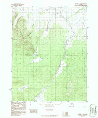
1986 Map of Hughes C-3
USGS Topo · Published 1986About this map
Gates of the Arctic National Preserve defines the western landscape of this subarctic region, where the Continental Divide cuts through the high ground. The terrain is dominated by the Norutak Hills, a series of elevations that shape the local drainage and topographic character. Flowing through the eastern portion of the map, the Hogatza River serves as a primary geographic landmark, winding through the lowlands and wetlands that separate the surrounding peaks. This 1980s-era survey, based on photography from the early 1970s, captures the area in a state of wilderness preservation. With no roads or trails recorded, the map emphasizes the natural hydrography and elevation contours that have long dictated movement and subsistence in this part of the Yukon-Koyukuk region.
Find a feature on this map
4 named features on this map. Tap any name to fly to it.
Don’t see what you’re looking for? This feature index may not catch every label — zoom into the map to look around manually.
Map Details
Editions of this 1986 Hughes C-3 Map
This is the sole edition of this map. No revisions or reprints were ever made.
Other maps of this area

1951 · Hughes
USGS Topo · 1:250,000

1956 · Hughes
USGS Topo · 1:250,000

1964 · Hughes
USGS Topo · 1:250,000

1965 · Hughes
USGS Topo · 1:250,000
1986 · Hughes B-4
USGS Topo · 1:63,360
1986 · Hughes D-4
USGS Topo · 1:63,360
1986 · Hughes B-2
USGS Topo · 1:63,360
1986 · Hughes C-4
USGS Topo · 1:63,360
1986 · Hughes D-3
USGS Topo · 1:63,360
1986 · Hughes B-3
USGS Topo · 1:63,360