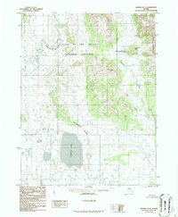
1986 Map of Hughes D-3
USGS Topo · Published 1986About this map
Gates of the Arctic National Preserve dominates the northern landscape of this 1980s-era topographic study, where the waters of the Kobuk River navigate through the Upper Kobuk Canyon. The hydrological significance of the region is centered on Norutak Lake and the nearby marshlands identified as Wl 713 and Wl 730. The Continental Divide winds through the center of the sheet, dictating the flow of unnamed tributaries and the headwaters of the Hogatza River. To the east, the Helpmejack Hills rise as a prominent geographic barrier. This provisional survey captures a remote wilderness without roads or established trails, defined instead by its drainage patterns and the transition between high ridges and lake-dotted lowlands.
Find a feature on this map
12 named features on this map. Tap any name to fly to it.
Don’t see what you’re looking for? This feature index may not catch every label — zoom into the map to look around manually.
Map Details
Editions of this 1986 Hughes D-3 Map
This is the sole edition of this map. No revisions or reprints were ever made.
Other maps of this area

1951 · Hughes
USGS Topo · 1:250,000

1951 · Survey Pass
USGS Topo · 1:250,000

1956 · Hughes
USGS Topo · 1:250,000

1956 · Survey Pass
USGS Topo · 1:250,000

1964 · Survey Pass
USGS Topo · 1:250,000

1964 · Hughes
USGS Topo · 1:250,000

1965 · Hughes
USGS Topo · 1:250,000

1966 · Survey Pass
USGS Topo · 1:250,000
1986 · Survey Pass A-4
USGS Topo · 1:63,360
1986 · Hughes C-3
USGS Topo · 1:63,360