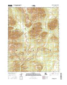
2016 Map of Hughes D-2 NW
USGS Topo · Published 2016About this map
The Continental Divide traverses the center of this northern Alaska landscape, a significant geographical marker within the Gates of the Arctic National Preserve. This terrain is characterized by the prominent elevation of the Helpmejack Hills, which dominate the eastern portion of the survey area. To the far east, the waters of Helpmejack Cr skirt the edge of these highlands, providing a rare hydrographic feature in this high-latitude wilderness. The absence of roads or permanent settlements underscores the remote and protected status of this interior region during the early twenty-first century, preserving the land as it has existed for generations. This map captures the intersection of dramatic relief and national conservation efforts, where topographic contours reveal the true shape of the Alaskan interior.
Find a feature on this map
10 named features on this map. Tap any name to fly to it.
Don’t see what you’re looking for? This feature index may not catch every label — zoom into the map to look around manually.
Map Details
Editions of this 2016 Hughes D-2 NW Map
This is the sole edition of this map. No revisions or reprints were ever made.
Other maps of this area

1951 · Hughes
USGS Topo · 1:250,000

1951 · Survey Pass
USGS Topo · 1:250,000

1956 · Hughes
USGS Topo · 1:250,000

1956 · Survey Pass
USGS Topo · 1:250,000

1964 · Survey Pass
USGS Topo · 1:250,000

1964 · Hughes
USGS Topo · 1:250,000

1965 · Hughes
USGS Topo · 1:250,000

1966 · Survey Pass
USGS Topo · 1:250,000
1986 · Survey Pass A-3
USGS Topo · 1:63,360
1986 · Hughes D-3
USGS Topo · 1:63,360