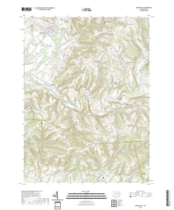
2023 Map of Hughesville
USGS Topo · Published 2023About this map
Hughesville serves as the primary hub in this corner of Pennsylvania, where the waters of Sugar Run and Greggs Run meet the larger Muncy Creek. The settlement pattern reflects a landscape defined by sharp elevation changes, particularly in the southern half where the Muncy Hills rise above the drainage of the West Branch Chillisquaque Creek. Outside the main town, smaller clusters like Clarkstown and Moreland are interspersed with several family and community burial grounds, including Pleasant Hill Cem and the Moreland Baptist Cem. The northern terrain is marked by significant ridges such as Metler Ridge and Ball Ridge, separated by deep cuts like Miller Hollow. This map traces a sophisticated network of rural roads that navigate these geological barriers, connecting isolated settlements to the larger valley economies.
Find a feature on this map
138 named features on this map. Tap any name to fly to it.
Don’t see what you’re looking for? This feature index may not catch every label — zoom into the map to look around manually.
Map Details
Editions of this 2023 Hughesville Map
This is the sole edition of this map. No revisions or reprints were ever made.
Other maps of this area

1924 · Milton
USGS Topo · 1:62,500

1927 · Eagles Mere
USGS Topo · 1:48,000

1930 · Warrensville
USGS Topo · 1:62,500

1932 · Eagle Mere
USGS Topo · 1:62,500

1934 · Warrensville
USGS Topo · 1:62,500

1935 · Hughesville
USGS Topo · 1:62,500

1953 · Hughesville
USGS Topo · 1:62,500

1953 · Warrensville
USGS Topo · 1:62,500

1953 · Eagles Mere
USGS Topo · 1:62,500

1953 · Milton
USGS Topo · 1:62,500
Featured Places
- Moreland Township, PA
- Madison Township, PA
- Anthony Township, PA
- Muncy Creek Township, PA
- Penn Township, PA