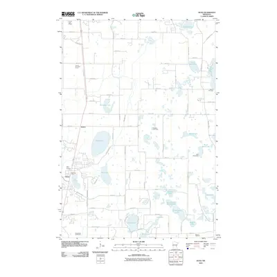
2010 Map of Hugo
USGS Topo · Published 2010About this map
Glacial lakes and marshlands define this portion of Washington County, where the growing settlement of Hugo serves as a local hub. The landscape is dotted with numerous water bodies, including the expansive Oneka Lake and Big Marine Lake, reflecting the region's post-glacial topography. To the north, Weston sits near a dense network of country roads, while institutional landmarks like the Veterans Rest Camp and Campfire Girls Camp point to the area's history as a recreational and retreat destination. Small-scale infrastructure, such as the Kelly Farms Dam, managed the flow of waters through Hardwood Creek and the various marshy basins like Maple Marsh Lake. Genealogists may find value in the inclusion of Saint Johns Cemetery and Withrow Cemetery, which anchor the local community history alongside the central Hugo Post Office. Transitioning from rural farmland to suburban outskirts, the map captures a period of modern development integrated with environmental features like Rice Lake and the North School Section Lake.
Find a feature on this map
73 named features on this map. Tap any name to fly to it.
Don’t see what you’re looking for? This feature index may not catch every label — zoom into the map to look around manually.
Map Details
Editions of this 2010 Hugo Map
This is the sole edition of this map. No revisions or reprints were ever made.
Other maps of this area

1902 · White Bear
USGS Topo · 1:62,500

1948 · Stillwater
USGS Topo · 1:62,500

1949 · Stillwater
USGS Topo · 1:62,500

1951 · White Bear Lake East
USGS Topo · 1:24,000

1951 · Stillwater
USGS Topo · 1:24,000

1952 · Centerville
USGS Topo · 1:24,000

1952 · White Bear Lake West
USGS Topo · 1:24,000

1953 · Stillwater
USGS Topo · 1:250,000

1954 · Hugo
USGS Topo · 1:24,000

1955 · Marine
USGS Topo · 1:24,000