
1954 Map of Hugo
USGS Topo · Published 1956About this map
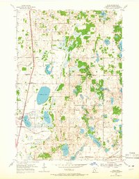
The Northern Pacific railroad corridor anchors the western edge of this mid-century landscape, passing directly through the community of Hugo and the smaller settlement of Weston. This area of Washington County is characterized by a high density of rural schools and small glacial lakes, reflecting a dispersed agricultural population still tied to localized community centers. Notable among these are Hopkins Sch, Tingley Sch, and Johnson Sch, spaced frequently throughout the townships of Oneka and May.
Find a feature on this map
33 named features on this map. Tap any name to fly to it.
Don’t see what you’re looking for? This feature index may not catch every label — zoom into the map to look around manually.
Map Details
Editions of this 1954 Hugo Map
2 editions found
Other maps of this area

1902 · White Bear
USGS Topo · 1:62,500

1948 · Stillwater
USGS Topo · 1:62,500

1949 · Stillwater
USGS Topo · 1:62,500

1951 · White Bear Lake East
USGS Topo · 1:24,000

1951 · Stillwater
USGS Topo · 1:24,000

1952 · Centerville
USGS Topo · 1:24,000

1952 · White Bear Lake West
USGS Topo · 1:24,000

1953 · Stillwater
USGS Topo · 1:250,000

1955 · Marine
USGS Topo · 1:24,000

1955 · Forest Lake
USGS Topo · 1:62,500