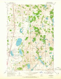
1954 Map of Hugo
USGS Topo · Published 1965About this map
Hugo serves as a central hub on this mid-century survey of Washington and Anoka Counties, anchored by the Northern Pacific railroad line that cuts through the western edge of the township. The landscape is defined by its glaciated hydrology, where substantial water bodies like Oneka Lake, Rice Lake, and Egg Lake sit amidst a network of drainage ways such as Hardwood Creek. This era of the 1950s shows a distributed rural society sustained by a high density of local institutions, evidenced by the numerous district schools including Hopkins Sch, Johnson Sch, and Tingley Sch scattered across the countryside. To the southeast, the M St P & S Ste M rail corridor passes near Withrow Cem, while a lone Gravel Pit indicates the local industry supporting the expansion of the surrounding road network.
Find a feature on this map
35 named features on this map. Tap any name to fly to it.
Don’t see what you’re looking for? This feature index may not catch every label — zoom into the map to look around manually.
Map Details
Editions of this 1954 Hugo Map
2 editions found
Other maps of this area

1902 · White Bear
USGS Topo · 1:62,500

1948 · Stillwater
USGS Topo · 1:62,500

1949 · Stillwater
USGS Topo · 1:62,500

1951 · White Bear Lake East
USGS Topo · 1:24,000

1951 · Stillwater
USGS Topo · 1:24,000

1952 · Centerville
USGS Topo · 1:24,000

1952 · White Bear Lake West
USGS Topo · 1:24,000

1953 · Stillwater
USGS Topo · 1:250,000

1954 · Hugo
USGS Topo · 1:24,000

1955 · Marine
USGS Topo · 1:24,000