2019 Map of Hugo
USGS Topo · Published 2019About this map
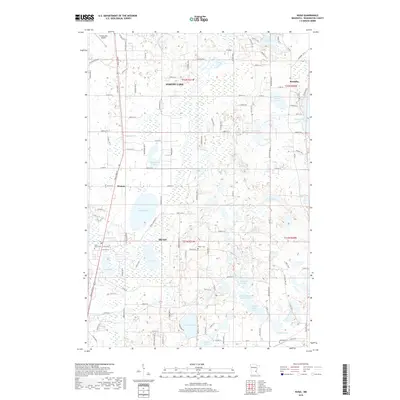
Hugo and Forest Lake define this Washington County landscape, which is marked by a dense concentration of glacial lakes and wetlands. The area transitions from the more developed corridor along Forest Blvd N to the open acreage near Scandia in the northeast. This 2019 survey documents a network of rural roads and residential expansion that winds between numerous water bodies, such as Oneka Lake and Plaisted Lake. Local history and genealogy are anchored by several notable burying grounds, including Saint John's Cem near the southern edge of Forest Lake and Walker Cem further east. The map also traces the path of Hardwood Cr as it flows through the central portion of the quadrangle, illustrating the complex drainage patterns of this lake-rich region.
Find a feature on this map
106 named features on this map. Tap any name to fly to it.
Don’t see what you’re looking for? This feature index may not catch every label — zoom into the map to look around manually.
Map Details
Editions of this 2019 Hugo Map
This is the sole edition of this map. No revisions or reprints were ever made.
Other maps of this area

1902 · White Bear
USGS Topo · 1:62,500

1948 · Stillwater
USGS Topo · 1:62,500

1949 · Stillwater
USGS Topo · 1:62,500

1951 · White Bear Lake East
USGS Topo · 1:24,000

1951 · Stillwater
USGS Topo · 1:24,000

1952 · Centerville
USGS Topo · 1:24,000

1952 · White Bear Lake West
USGS Topo · 1:24,000

1953 · Stillwater
USGS Topo · 1:250,000

1954 · Hugo
USGS Topo · 1:24,000

1955 · Marine
USGS Topo · 1:24,000