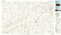
1983 Map of Hugoton
USGS Topo · Published 1984About this map
The Old Santa Fe Trail cuts across the southwestern corner of Kansas, tracing a path through the expansive Cimarron National Grassland. This 1980s landscape is defined by the energy sector, with a sprawling Gas Field underlying much of Stevens and Morton counties. The Cimarron River and its North Fork provide the primary drainage through the high plains terrain, with rare water sources like Warm Bird Spring appearing in an otherwise arid environment.
Find a feature on this map
29 named features on this map. Tap any name to fly to it.
Don’t see what you’re looking for? This feature index may not catch every label — zoom into the map to look around manually.
Map Details
Editions of this 1983 Hugoton Map
This is the sole edition of this map. No revisions or reprints were ever made.
Other maps of this area

1891 · Albany
USGS Topo · 1:125,000

1891 · Larned
USGS Topo · 1:125,000

1892 · Vilas
USGS Topo · 1:125,000

1893 · Albany
USGS Topo · 1:125,000

1896 · Garden
USGS Topo · 1:125,000

1900 · Syracuse
USGS Topo · 1:125,000

1900 · Lakin
USGS Topo · 1:125,000

1920 · Syracuse
USGS Topo · 1:125,000

1944 · Moscow
USGS Topo · 1:62,500

1945 · Moscow
USGS Topo · 1:62,500