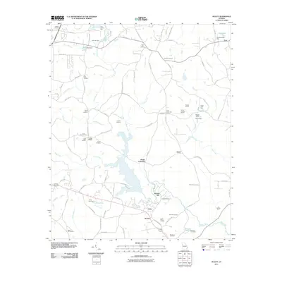
2011 Map of Hulett
USGS Topo · Published 2011About this map
Snake Creek winds through the heart of this landscape, serving as a focal point for the historic settlements of Banning and Banning Mills. The area is characterized by its numerous family and community burial grounds, which offer significant value for genealogical research. Notable sites include the New Hope Cemetery, Mount Carmel Cemetery, and Cross Plains Cemetery located near the Cross Plains crossroads.
Find a feature on this map
102 named features on this map. Tap any name to fly to it.
Don’t see what you’re looking for? This feature index may not catch every label — zoom into the map to look around manually.
Map Details
Editions of this 2011 Hulett Map
This is the sole edition of this map. No revisions or reprints were ever made.
Other maps of this area

1889 · Tallapoosa
USGS Topo · 1:125,000

1891 · Marietta
USGS Topo · 1:125,000
1892 · Tallapoosa
USGS Topo · 1:125,000

1895 · Marietta
USGS Topo · 1:125,000

1897 · Marietta
USGS Topo · 1:125,000
1897 · Tallapoosa
USGS Topo · 1:125,000

1899 · Wedowee
USGS Topo · 1:125,000

1901 · Marietta
USGS Topo · 1:125,000

1902 · Wedowee
USGS Topo · 1:125,000

1953 · Atlanta
USGS Topo · 1:250,000