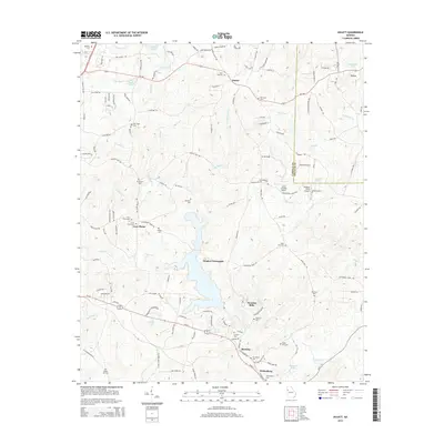
2014 Map of Hulett
USGS Topo · Published 2014About this map
Whitesburg serves as a primary settlement node in this survey of the Carroll County landscape, situated near the winding course of Snake Cr. The area is characterized by several small communities and rural intersections, including Banning, Hulett, and Dingler Crossroads. This portion of Georgia is notable for its high density of family and community burial grounds, such as Bethany Cem, New Hope Cem, and Antioch Cem, which offer significant genealogical data for researchers of the region's heritage. The landscape is deeply tied to its watercourses, with Guthrie Cr and Wolf Cr cutting through the terrain. A legacy of local industry is preserved in the naming of Banning Mills, while the presence of small air strips like Kolibri Airport and Smisson Field Airport indicates the modern utility of the open rural reaches between these established towns.
Find a feature on this map
144 named features on this map. Tap any name to fly to it.
Don’t see what you’re looking for? This feature index may not catch every label — zoom into the map to look around manually.
Map Details
Editions of this 2014 Hulett Map
This is the sole edition of this map. No revisions or reprints were ever made.
Other maps of this area

1889 · Tallapoosa
USGS Topo · 1:125,000

1891 · Marietta
USGS Topo · 1:125,000

1892 · Tallapoosa
USGS Topo · 1:125,000

1895 · Marietta
USGS Topo · 1:125,000

1897 · Marietta
USGS Topo · 1:125,000

1897 · Tallapoosa
USGS Topo · 1:125,000

1899 · Wedowee
USGS Topo · 1:125,000

1901 · Marietta
USGS Topo · 1:125,000

1902 · Wedowee
USGS Topo · 1:125,000

1953 · Atlanta
USGS Topo · 1:250,000