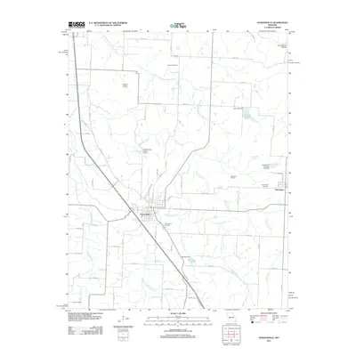
2011 Map of Humansville
USGS Topo · Published 2011About this map
Humansville serves as the central hub for this corner of Polk County, where the street grid meets the diagonal path of the regional highway. The landscape is defined by the winding course of South Fork Weaubleau Creek and Panther Creek, which cut through the surrounding agricultural lands. Smaller settlements like Flemington and Round Prairie anchor the eastern and northern portions of the map, while numerous family and community burial grounds, including Souders Cemetery and Tinker Cemetery, provide points of interest for genealogists tracking local ancestry. Several water management structures, such as the Alley Lake Dam and Sprowls Dam, illustrate the 21st-century hydrological landscape, specifically around Pocomo Lake. The detailed road network, from named avenues like Blair Ave to numbered routes such as Co Rd 290, shows the modern connectivity of this Missouri farming region.
Find a feature on this map
66 named features on this map. Tap any name to fly to it.
Don’t see what you’re looking for? This feature index may not catch every label — zoom into the map to look around manually.
Map Details
Editions of this 2011 Humansville Map
This is the sole edition of this map. No revisions or reprints were ever made.
Other maps of this area

1884 · Bolivar
USGS Topo · 1:125,000

1886 · Stockton
USGS Topo · 1:125,000

1892 · Bolivar
USGS Topo · 1:125,000

1938 · Vista
USGS Topo · 1:24,000

1939 · Arnica
USGS Topo · 1:24,000

1940 · Vista
USGS Topo · 1:24,000

1940 · Weaubleau
USGS Topo · 1:24,000

1941 · Arnica
USGS Topo · 1:24,000

1942 · Elkton
USGS Topo · 1:24,000

1944 · Humansville
USGS Topo · 1:24,000