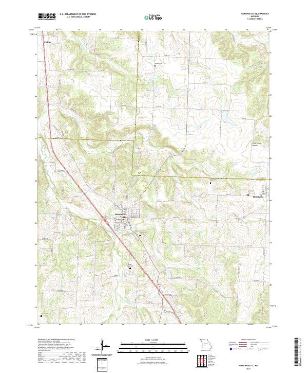
2021 Map of Humansville
USGS Topo · Published 2021About this map
Humansville and the neighboring settlements of Flemington and Collins anchor this central Missouri landscape where the borders of Polk, St. Clair, and Hickory counties meet. The map reveals a high concentration of burial grounds, including the Humansville Cem, Shady Grove Cem, and Tinker Cem, which are essential for genealogists tracing family roots through these rural townships. The terrain is defined by a network of seasonal and perennial waterways such as S Fork Weaubleau Cr, Panther Cr, and Brush Cr, which carve through the land and feed into Pocomo Lake. The layout of local road networks, including numerous named routes like E 340th RD and State Hwy N, illustrates the modern connectivity of these agricultural communities while preserving the locations of historical landmarks like Cave Spring Hollow.
Find a feature on this map
80 named features on this map. Tap any name to fly to it.
Don’t see what you’re looking for? This feature index may not catch every label — zoom into the map to look around manually.
Map Details
Editions of this 2021 Humansville Map
This is the sole edition of this map. No revisions or reprints were ever made.
Other maps of this area

1884 · Bolivar
USGS Topo · 1:125,000

1886 · Stockton
USGS Topo · 1:125,000

1892 · Bolivar
USGS Topo · 1:125,000

1938 · Vista
USGS Topo · 1:24,000

1939 · Arnica
USGS Topo · 1:24,000

1940 · Vista
USGS Topo · 1:24,000

1940 · Weaubleau
USGS Topo · 1:24,000

1941 · Arnica
USGS Topo · 1:24,000

1942 · Elkton
USGS Topo · 1:24,000

1944 · Humansville
USGS Topo · 1:24,000