
1969 Map of Humble City
USGS Topo · Published 1971About this map
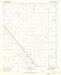
The vast industrial and oil-production landscape of Lea County is captured in this late-1960s survey. The terrain is defined by the shallow depression of Wardswell Draw, which cuts across the high plains of the Llano Estacado. This era was marked by an extensive infrastructure of resource extraction, evidenced by a dense network of pipelines and numerous well sites distributed across the township grids. A Radio Tower in the southeast quadrant and several Gravel Pits illustrate the localized development supporting the regional petroleum economy and road network of the New Mexico plains.
Find a feature on this map
7 named features on this map. Tap any name to fly to it.
Don’t see what you’re looking for? This feature index may not catch every label — zoom into the map to look around manually.
Map Details
Editions of this 1969 Humble City Map
4 editions found
Other maps of this area

1954 · Hobbs
USGS Topo · 1:250,000

1958 · Hobbs
USGS Topo · 1:250,000

1962 · Lovington
USGS Topo · 1:24,000

1962 · Lovington
USGS Topo · 1:62,500

1963 · Monument
USGS Topo · 1:62,500

1969 · Hobbs East
USGS Topo · 1:24,000

1969 · Humble City NE
USGS Topo · 1:24,000

1969 · Hobbs West
USGS Topo · 1:24,000

1969 · Humble City SE
USGS Topo · 1:24,000

1970 · Humble City SE
USGS Topo · 1:24,000