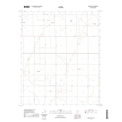
2020 Map of Humble City NW
USGS Topo · Published 2020About this map
Wardswell Draw meanders through this section of the High Plains, carving a subtle drainage pattern across the arid landscape of Lea County. This 2020 edition from the U.S. Geological Survey illustrates a highly organized grid of rural roads and section lines, characteristic of the region's ranching and energy-driven economy. Long straightaways such as Midway Rd and Wilks Rd connect isolated homesteads and industrial sites, including the Double J area. The presence of named tracks like Slick Rd and Marlee suggests a landscape defined by local transit between remote parcels. Topographically, the map reveals the gentle undulations of the Llano Estacado, where minor elevation changes dictate the flow of ephemeral water towards the draw. The network of county roads, including Co Rd 88 and Knowles Rd, provides a clear view of modern land division and access in this corner of southeastern New Mexico.
Find a feature on this map
23 named features on this map. Tap any name to fly to it.
Don’t see what you’re looking for? This feature index may not catch every label — zoom into the map to look around manually.
Map Details
Editions of this 2020 Humble City NW Map
This is the sole edition of this map. No revisions or reprints were ever made.
Other maps of this area

1954 · Hobbs
USGS Topo · 1:250,000

1954 · Brownfield
USGS Topo · 1:250,000

1958 · Brownfield
USGS Topo · 1:250,000

1958 · Hobbs
USGS Topo · 1:250,000

1962 · Brownfield
USGS Topo · 1:250,000

1962 · Lovington
USGS Topo · 1:24,000

1962 · Lovington
USGS Topo · 1:62,500

1969 · Humble City
USGS Topo · 1:24,000

1969 · Humble City NE
USGS Topo · 1:24,000

1969 · Humble City SE
USGS Topo · 1:24,000