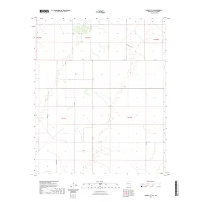
2023 Map of Humble City NW
USGS Topo · Published 2023About this map
Wardswell Draw carves a subtle path through the high plains of Lea County, serving as the primary drainage feature in this corner of the Llano Estacado. The landscape is defined by the rigid geometry of the Public Land Survey System, with the intersection of Township 15 South and Township 16 South meeting at the boundary of Ranges 37 and 38 East. This contemporary survey by the U.S. Geological Survey reflects a region organized around ranching and rural infrastructure, where long straightaways like Midway Rd and S Prairieview Rd delineate the open range.
Find a feature on this map
23 named features on this map. Tap any name to fly to it.
Don’t see what you’re looking for? This feature index may not catch every label — zoom into the map to look around manually.
Map Details
Editions of this 2023 Humble City NW Map
This is the sole edition of this map. No revisions or reprints were ever made.
Other maps of this area

1954 · Hobbs
USGS Topo · 1:250,000

1954 · Brownfield
USGS Topo · 1:250,000

1958 · Brownfield
USGS Topo · 1:250,000

1958 · Hobbs
USGS Topo · 1:250,000

1962 · Brownfield
USGS Topo · 1:250,000

1962 · Lovington
USGS Topo · 1:24,000

1962 · Lovington
USGS Topo · 1:62,500

1969 · Humble City
USGS Topo · 1:24,000

1969 · Humble City NE
USGS Topo · 1:24,000

1969 · Humble City SE
USGS Topo · 1:24,000