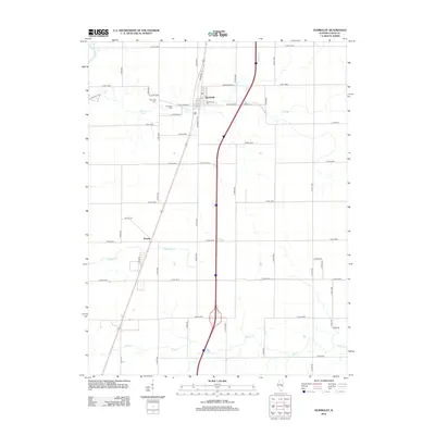
2012 Map of Humboldt
USGS Topo · Published 2012About this map
Humboldt serves as the primary center of activity in this section of Coles County, characterized by a grid of streets such as Washington St and Southside Dr that cluster around the local Po. The surrounding landscape is defined by its agricultural layout, intersected by a network of drainage systems including Flat Br and Riley Cr. To the southwest, the smaller settlement of Dorans sits along the roadway, illustrating the historical pattern of small-town development in the Illinois prairie.
Find a feature on this map
51 named features on this map. Tap any name to fly to it.
Don’t see what you’re looking for? This feature index may not catch every label — zoom into the map to look around manually.
Map Details
Editions of this 2012 Humboldt Map
This is the sole edition of this map. No revisions or reprints were ever made.
Other maps of this area

1933 · Toledo
USGS Topo · 1:62,500

1934 · Mattoon
USGS Topo · 1:62,500

1935 · Arcola
USGS Topo · 1:48,000

1936 · Oakland
USGS Topo · 1:48,000

1937 · Mattoon
USGS Topo · 1:62,500

1938 · Toledo
USGS Topo · 1:62,500

1940 · Arcola
USGS Topo · 1:62,500

1942 · Oakland
USGS Topo · 1:62,500

1958 · Decatur
USGS Topo · 1:250,000

1961 · Decatur
USGS Topo · 1:250,000