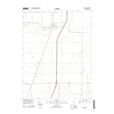
2015 Map of Humboldt
USGS Topo · Published 2015About this map
Humboldt and the smaller settlement of Dorans anchor this Coles County landscape, where the flat agricultural terrain of central Illinois is etched by a network of local tributaries. The village of Humboldt is organized around a traditional street grid featuring Washington St, Broadway St, and Jefferson St, while the surrounding countryside is defined by the rigid geometry of county roads. Genealogists will find the Township Cem and Humboldt Cem preserved within these farm fields. The hydrography of the region is dominated by southern-flowing waters, including Flat Br, Crabapple Cr, and Riley Cr, while a segment of the Kaskaskia River cuts through the northwest corner. This 2015 data reflects the modern persistence of these small rural communities alongside established transportation corridors, including a subdivision at Northfield.
Find a feature on this map
39 named features on this map. Tap any name to fly to it.
Don’t see what you’re looking for? This feature index may not catch every label — zoom into the map to look around manually.
Map Details
Editions of this 2015 Humboldt Map
This is the sole edition of this map. No revisions or reprints were ever made.
Other maps of this area

1933 · Toledo
USGS Topo · 1:62,500

1934 · Mattoon
USGS Topo · 1:62,500

1935 · Arcola
USGS Topo · 1:48,000

1936 · Oakland
USGS Topo · 1:48,000

1937 · Mattoon
USGS Topo · 1:62,500

1938 · Toledo
USGS Topo · 1:62,500

1940 · Arcola
USGS Topo · 1:62,500

1942 · Oakland
USGS Topo · 1:62,500

1958 · Decatur
USGS Topo · 1:250,000

1961 · Decatur
USGS Topo · 1:250,000