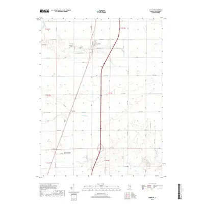
2018 Map of Humboldt
USGS Topo · Published 2018About this map
Humboldt and its surrounding township define this agricultural landscape in Coles County, where the village is centered on Commercial St and Adams St. The terrain is drained by several small watercourses, including Flat Br in the north and Crabapple Cr through the center, leading toward the northern edge of Mattoon. Genealogists will find the Humboldt Township Cem and Humboldt Cem clearly marked just outside the main settlement. The map reveals the precise layout of the rural road network, with established routes like Wetzel Rd and Apple Dr connecting the smaller settlement of Dorans to the larger centers. This survey documents the transition from village streets to the rectilinear grid of county roads that supports the region's farming economy, alongside the essential waterways like Riley Cr in the south.
Find a feature on this map
35 named features on this map. Tap any name to fly to it.
Don’t see what you’re looking for? This feature index may not catch every label — zoom into the map to look around manually.
Map Details
Editions of this 2018 Humboldt Map
This is the sole edition of this map. No revisions or reprints were ever made.
Other maps of this area

1933 · Toledo
USGS Topo · 1:62,500

1934 · Mattoon
USGS Topo · 1:62,500

1935 · Arcola
USGS Topo · 1:48,000

1936 · Oakland
USGS Topo · 1:48,000

1937 · Mattoon
USGS Topo · 1:62,500

1938 · Toledo
USGS Topo · 1:62,500

1940 · Arcola
USGS Topo · 1:62,500

1942 · Oakland
USGS Topo · 1:62,500

1958 · Decatur
USGS Topo · 1:250,000

1961 · Decatur
USGS Topo · 1:250,000