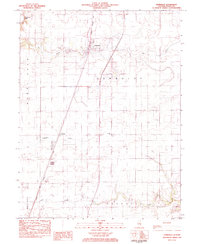
1983 Map of Humboldt
USGS Topo · Published 1983About this map
Humboldt serves as the central hub of this Coles County landscape in the early 1980s, positioned along the north-south corridor of the Illinois Central Gulf railroad. The village is well-defined by its grid, proximity to the Humboldt Cem, and the nearby Sewage Treatment Plant, reflecting a small Illinois prairie town at its late-century peak. To the southwest, the smaller settlement of Dorans sits along the same rail line, while Riley marks the southern reach of the survey near Riley Creek.
Find a feature on this map
18 named features on this map. Tap any name to fly to it.
Don’t see what you’re looking for? This feature index may not catch every label — zoom into the map to look around manually.
Map Details
Editions of this 1983 Humboldt Map
This is the sole edition of this map. No revisions or reprints were ever made.
Other maps of this area

1933 · Toledo
USGS Topo · 1:62,500

1934 · Mattoon
USGS Topo · 1:62,500

1935 · Arcola
USGS Topo · 1:48,000

1936 · Oakland
USGS Topo · 1:48,000

1937 · Mattoon
USGS Topo · 1:62,500

1938 · Toledo
USGS Topo · 1:62,500

1940 · Arcola
USGS Topo · 1:62,500

1942 · Oakland
USGS Topo · 1:62,500

1958 · Decatur
USGS Topo · 1:250,000

1961 · Decatur
USGS Topo · 1:250,000