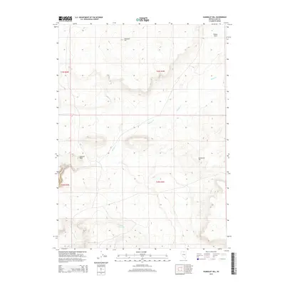
2015 Map of Humboldt Hill
USGS Topo · Published 2015About this map
Humboldt Hill stands as a prominent landmark in this high-desert landscape of Elko County, marking a terrain defined by subtle elevation shifts and seasonal water drainage. The north-flowing Milligan Cr carves a path through the center of the sheet, eventually reaching toward the expanse of the Owyhee Desert in the northeast corner. This 2015 survey illustrates a land primarily managed for ranching and water conservation, as evidenced by the presence of Rocky Reservoir in the southern portion of the quadrangle. Isolated peaks such as Fourmile Butte and Elevenmile Hill provide clear reference points for navigation across the open sagebrush country. The map's grid-like sections reveal the systematic division of these public lands, showing a landscape where few roads penetrate the interior, preserving the character of the Great Basin wilderness.
Find a feature on this map
10 named features on this map. Tap any name to fly to it.
Don’t see what you’re looking for? This feature index may not catch every label — zoom into the map to look around manually.
Map Details
Editions of this 2015 Humboldt Hill Map
This is the sole edition of this map. No revisions or reprints were ever made.
Other maps of this area

1882 · Paradise
USGS Topo · 1:250,000

1893 · Paradise
USGS Topo · 1:250,000

1955 · McDermitt
USGS Topo · 1:250,000

1959 · McDermitt
USGS Topo · 1:250,000
1973 · Rodear Flat
USGS Topo · 1:24,000

1973 · McCleary Wells
USGS Topo · 1:24,000

1973 · Button Lake Well
USGS Topo · 1:24,000

1973 · Corral Lake
USGS Topo · 1:24,000

1973 · Haystack Peak
USGS Topo · 1:24,000

1973 · Humboldt Hill
USGS Topo · 1:24,000